Area Overview for DE73 6RQ
Photos of DE73 6RQ
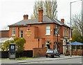
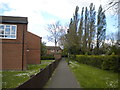
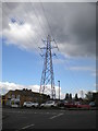
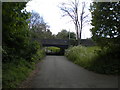
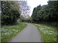


64 photos from this area
Area Information
Key information about the DE73 6RQ including its size, population, and administrative classification.
- Area Type
- Postcode
- Area Size
- 4809 m²
- Population
- 1937
- Population Density
- 3563 people/km²
House Prices in DE73 6RQ
8
Properties
£246,286
Average Sold Price
£60,000
Lowest Price
£386,500
Highest Price
Showing 8 properties
| Address | Type | Beds | Baths | Last Sale Price | Last Sale Date | |
|---|---|---|---|---|---|---|
| 210 Derby Road, Chellaston, Derby, DE73 6RQ | house | - | - | £260,000 | Sep 2022 | |
| 222 Derby Road, Chellaston, Derby, DE73 6RQ | house | - | - | £380,000 | Mar 2021 | |
| 214 Derby Road, Chellaston, Derby, DE73 6RQ | Semi-detached | 3 | - | £285,000 | Nov 2020 | |
| 212 Derby Road, Chellaston, Derby, DE73 6RQ | Semi-detached | 2 | 1 | £130,000 | Jun 2015 | |
| 216 Derby Road, Chellaston, Derby, DE73 6RQ | Semi-detached | 2 | - | £222,500 | Jul 2014 | |
| 198 Derby Road, Chellaston, Derby, DE73 6RQ | house | - | - | £386,500 | Dec 2012 | |
| 218 Derby Road, Chellaston, Derby, DE73 6RQ | Detached | - | - | £60,000 | May 1996 | |
| Annexe, 198 Derby Road, Chellaston, Derby, DE73 6RQ | Detached | - | - | - | - |
Energy Efficiency in DE73 6RQ
Amenities
Schools
| Rank | School | Type | Entry gender | Ages |
|---|
Explore more schools in this area
Go to Schools tabDemographics
Household Size
Two person
most common
Accommodation Type
Houses
most common
Tenure
86
majority
Ethnic Group
White
most common
Religion
N/A
most common
Household Composition
N/A
most common
Age
47
median
Adults (30-64 years)
most common
Household Deprivation
N/A
with no deprivation
NS-SEC
44
in Lower managerial occupations
Explore more demographic insights in this area
Go to Demographics tabPlanning
Planning Constraints
- Flood RiskPremium
- Ramsar Wetland SitesPremium
- Area of Outstanding Natural BeautyPremium
- Protected Nature ReservePremium
- Protected WoodlandPremium