Area Overview for DE73 5WQ
Photos of DE73 5WQ
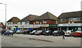
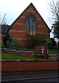


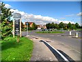
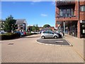
62 photos from this area
Area Information
Key information about the DE73 5WQ including its size, population, and administrative classification.
- Area Type
- Postcode
- Area Size
- 3.1 hectares
- Population
- 1783
- Population Density
- 1602 people/km²
House Prices in DE73 5WQ
32
Properties
£153,770
Average Sold Price
£69,000
Lowest Price
£407,000
Highest Price
Showing 32 properties
| Address | Type | Beds | Baths | Last Sale Price | Last Sale Date | |
|---|---|---|---|---|---|---|
| 12 Kildrummy Close, Derby, DE73 5WQ | house | 3 | 2 | £235,000 | Sep 2024 | |
| 4 Kildrummy Close, Derby, DE73 5WQ | house | 4 | 2 | £407,000 | Feb 2024 | |
| 21 Kildrummy Close, Derby, DE73 5WQ | house | - | - | £205,000 | Oct 2023 | |
| 7 Kildrummy Close, Derby, DE73 5WQ | house | - | - | £230,000 | Aug 2023 | |
| 17 Kildrummy Close, Derby, DE73 5WQ | Semi-detached | 3 | 2 | £238,000 | Mar 2023 | |
| 39 Kildrummy Close, Derby, DE73 5WQ | house | - | - | £130,000 | Feb 2022 | |
| 15 Kildrummy Close, Derby, DE73 5WQ | house | - | - | £142,000 | Apr 2020 | |
| 41 Kildrummy Close, Derby, DE73 5WQ | house | - | - | £137,000 | May 2019 | |
| 9 Kildrummy Close, Derby, DE73 5WQ | Semi-detached | 3 | 1 | £188,000 | May 2019 | |
| 47 Kildrummy Close, Derby, DE73 5WQ | house | - | - | £154,950 | Aug 2018 |
Page 1 of 4
Energy Efficiency in DE73 5WQ
Amenities
Schools
| Rank | School | Type | Entry gender | Ages |
|---|
Explore more schools in this area
Go to Schools tabDemographics
Household Size
Family (3-5 people)
most common
Accommodation Type
Houses
most common
Tenure
79
majority
Ethnic Group
White
most common
Religion
N/A
most common
Household Composition
N/A
most common
Age
47
median
Adults (30-64 years)
most common
Household Deprivation
N/A
with no deprivation
NS-SEC
45
in Lower managerial occupations
Explore more demographic insights in this area
Go to Demographics tabPlanning
Planning Constraints
- Flood RiskPremium
- Ramsar Wetland SitesPremium
- Area of Outstanding Natural BeautyPremium
- Protected Nature ReservePremium
- Protected WoodlandPremium