Area Overview for DE73 5TA
Photos of DE73 5TA
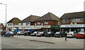
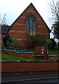


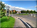
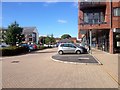
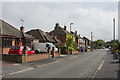
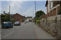
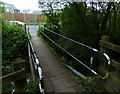
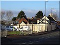
62 photos from this area
Area Information
Key information about the DE73 5TA including its size, population, and administrative classification.
- Area Type
- Postcode
- Area Size
- 8412 m²
- Population
- 1271
- Population Density
- 4132 people/km²
House Prices in DE73 5TA
11
Properties
£247,805
Average Sold Price
£59,995
Lowest Price
£365,050
Highest Price
Showing 11 properties
| Address | Type | Beds | Baths | Last Sale Price | Last Sale Date | |
|---|---|---|---|---|---|---|
| 93 Station Road, Chellaston, Derby, DE73 5TA | house | - | - | £312,500 | Mar 2021 | |
| 89 Station Road, Chellaston, Derby, DE73 5TA | house | 4 | - | £340,000 | Aug 2017 | |
| 101 Station Road, Chellaston, Derby, DE73 5TA | Detached | 5 | 2 | £364,000 | Jun 2017 | |
| 97 Station Road, Chellaston, Derby, DE73 5TA | house | - | - | £365,050 | Aug 2015 | |
| 89A Station Road, Chellaston, Derby, DE73 5TA | Detached | 3 | 3 | £235,000 | Aug 2014 | |
| Station House, 91 Station Road, Chellaston, Derby, DE73 5TA | Detached | 4 | - | £275,000 | Aug 2014 | |
| 99 Station Road, Chellaston, Derby, DE73 5TA | house | - | - | £260,000 | Jul 2010 | |
| 103 Station Road, Chellaston, Derby, DE73 5TA | house | - | - | £135,000 | May 2001 | |
| 95 Station Road, Chellaston, Derby, DE73 5TA | Detached | 4 | 1 | £59,995 | Dec 1998 | |
| 105 Station Road, Chellaston, Derby, DE73 5TA | Detached | - | - | £131,500 | Jun 1997 |
Page 1 of 2
Energy Efficiency in DE73 5TA
Amenities
Schools
| Rank | School | Type | Entry gender | Ages |
|---|
Explore more schools in this area
Go to Schools tabDemographics
Household Size
One person
most common
Accommodation Type
Houses
most common
Tenure
76
majority
Ethnic Group
White
most common
Religion
N/A
most common
Household Composition
N/A
most common
Age
47
median
Adults (30-64 years)
most common
Household Deprivation
N/A
with no deprivation
NS-SEC
37
in Lower managerial occupations
Explore more demographic insights in this area
Go to Demographics tabPlanning
Planning Constraints
- Flood RiskPremium
- Ramsar Wetland SitesPremium
- Area of Outstanding Natural BeautyPremium
- Protected Nature ReservePremium
- Protected WoodlandPremium