Area Overview for DE72 2AS
Photos of DE72 2AS
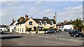


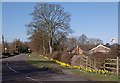
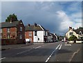

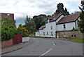
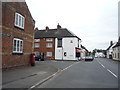


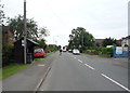
51 photos from this area
Area Information
Key information about the DE72 2AS including its size, population, and administrative classification.
- Area Type
- Postcode
- Area Size
- 2.3 hectares
- Population
- 2120
- Population Density
- 377 people/km²
House Prices in DE72 2AS
50
Properties
£237,632
Average Sold Price
£45,000
Lowest Price
£740,000
Highest Price
Showing 50 properties
| Address | Type | Beds | Baths | Last Sale Price | Last Sale Date | |
|---|---|---|---|---|---|---|
| 4 Weston Road, Aston On Trent, Derby, DE72 2AS | Terraced | 2 | 1 | £240,000 | Dec 2025 | |
| 40 Weston Road, Aston On Trent, Derby, DE72 2AS | Detached | 4 | 3 | £740,000 | Dec 2024 | |
| 17 Weston Road, Aston On Trent, Derby, DE72 2AS | Semi-detached | 3 | 1 | £205,000 | Dec 2024 | |
| 30 Weston Road, Aston On Trent, Derby, DE72 2AS | house | 3 | 1 | £482,000 | Nov 2024 | |
| 52 Weston Road, Aston On Trent, Derby, DE72 2AS | Semi-detached | 3 | 1 | £231,000 | Aug 2024 | |
| 9 Weston Road, Aston On Trent, Derby, DE72 2AS | Terraced | 2 | - | £220,000 | Jul 2022 | |
| 34 Weston Road, Aston On Trent, Derby, DE72 2AS | Cottage | 3 | - | £337,000 | Apr 2022 | |
| 21 Weston Road, Aston On Trent, Derby, DE72 2AS | house | 3 | - | £550,000 | Feb 2022 | |
| 22 Weston Road, Aston On Trent, Derby, DE72 2AS | house | 2 | - | £278,000 | May 2021 | |
| 14 Weston Road, Aston On Trent, Derby, DE72 2AS | Terraced | 2 | 1 | £175,000 | Oct 2020 |
Page 1 of 5
Energy Efficiency in DE72 2AS
Amenities
Schools
| Rank | School | Type | Entry gender | Ages |
|---|
Explore more schools in this area
Go to Schools tabDemographics
Household Size
Two person
most common
Accommodation Type
Houses
most common
Tenure
87
majority
Ethnic Group
White
most common
Religion
N/A
most common
Household Composition
N/A
most common
Age
47
median
Adults (30-64 years)
most common
Household Deprivation
N/A
with no deprivation
NS-SEC
51
in Lower managerial occupations
Explore more demographic insights in this area
Go to Demographics tabPlanning
Planning Constraints
- Flood RiskPremium
- Ramsar Wetland SitesPremium
- Area of Outstanding Natural BeautyPremium
- Protected Nature ReservePremium
- Protected WoodlandPremium