Area Overview for DE72 2AN
Photos of DE72 2AN

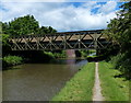
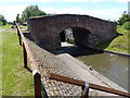
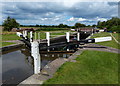
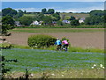
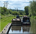
55 photos from this area
Area Information
Key information about the DE72 2AN including its size, population, and administrative classification.
- Area Type
- Postcode
- Area Size
- 20.7 hectares
- Population
- 2120
- Population Density
- 377 people/km²
House Prices in DE72 2AN
21
Properties
£274,750
Average Sold Price
£44,000
Lowest Price
£822,000
Highest Price
Showing 21 properties
| Address | Type | Beds | Baths | Last Sale Price | Last Sale Date | |
|---|---|---|---|---|---|---|
| Whispering Trees, Shardlow Road, Aston On Trent, Derby, DE72 2AN | Office | - | - | £50,000 | Jan 2019 | |
| White Cottage, Shardlow Road, Aston On Trent, Derby, DE72 2AN | Terraced | - | - | £822,000 | Jul 2008 | |
| The Stables, Shardlow Road, Aston On Trent, Derby, DE72 2AN | Land | - | - | £183,000 | May 2002 | |
| 1 Shardlow Road, Aston On Trent, Derby, DE72 2AN | Semi-detached | - | - | £44,000 | May 1998 | |
| The Cedars, Shardlow Road, Aston On Trent, Derby, DE72 2AN | Retail | 4 | 3 | - | - | |
| Caravan At, The Apiary, Shardlow Road, Aston On Trent, Derby, DE72 2AN | Mobile Home | - | - | - | - | |
| Oak Tree Stables, Shardlow Road, Aston On Trent, Derby, DE72 2AN | Leisure | - | - | - | - | |
| The Lodge, Shardlow Road, Aston On Trent, Derby, DE72 2AN | Detached | - | - | - | - | |
| Moorside House, Shardlow Road, Aston On Trent, Derby, DE72 2AN | Detached | - | - | - | - | |
| 1A Shardlow Road, Aston On Trent, Derby, DE72 2AN | Semi-detached | - | - | - | - |
Page 1 of 3
Energy Efficiency in DE72 2AN
Amenities
Schools
| Rank | School | Type | Entry gender | Ages |
|---|
Explore more schools in this area
Go to Schools tabDemographics
Household Size
Two person
most common
Accommodation Type
Houses
most common
Tenure
87
majority
Ethnic Group
White
most common
Religion
N/A
most common
Household Composition
N/A
most common
Age
47
median
Adults (30-64 years)
most common
Household Deprivation
N/A
with no deprivation
NS-SEC
51
in Lower managerial occupations
Explore more demographic insights in this area
Go to Demographics tabPlanning
Planning Constraints
- Flood RiskPremium
- Ramsar Wetland SitesPremium
- Area of Outstanding Natural BeautyPremium
- Protected Nature ReservePremium
- Protected WoodlandPremium