Area Overview for DE7 9WA
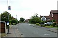
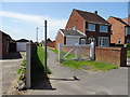
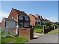
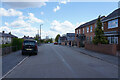
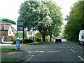
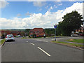
Photos of DE7 9WA

Area Information
Living in DE7 9WA offers a quiet, residential lifestyle within a small cluster of homes. With a population of just over 1,200, the area is compact but well-served by nearby amenities. The community is predominantly composed of adults aged 30–64, reflecting a mature demographic with strong home ownership. Most residents live in houses, creating a stable, family-oriented environment. The area’s proximity to rail and tram networks, including Ilkeston Railway Station and Phoenix Park Tram Stop, ensures easy access to nearby towns and cities. Daily life is shaped by local shops like Co-op Summerfield and Asda Ilkeston, while low crime rates and minimal environmental constraints contribute to a sense of security. DE7 9WA is ideal for those seeking a balanced mix of convenience and tranquillity, with no significant planning restrictions or natural hazards to complicate living here.
- Area Type
- Postcode
- Area Size
- Not available
- Population
- 1212
- Population Density
- 6423 people/km²
The property market in DE7 9WA is characterised by high home ownership, with 88% of residents living in owner-occupied homes. This suggests a market dominated by private residences rather than rental properties, indicating a preference for long-term investment in local housing. The accommodation type is exclusively houses, which are typically larger and suited to families or individuals prioritising space and privacy. Given the area’s small size and limited housing stock, buyers should expect a competitive market with fewer options. The high home ownership rate also implies lower turnover, meaning properties may remain on the market for extended periods. For those considering purchase, the focus is likely on established homes rather than new developments, with the potential for stable property values due to the area’s low environmental and safety risks.
House Prices in DE7 9WA
No properties found in this postcode.
Energy Efficiency in DE7 9WA
Daily life in DE7 9WA is supported by a range of nearby amenities within practical reach. Local retail options include Co-op Summerfield, Asda Ilkeston, and Aldi Cotmanhay, providing essential shopping and grocery needs. The area’s transport links are extensive, with four railway stations and five tram stops, including Bulwell Railway Station and Tram Park & Ride, facilitating easy travel to nearby hubs. While the data does not mention parks or leisure facilities directly, the absence of protected natural areas or planning constraints suggests open spaces may be available nearby. The combination of retail, transport, and low crime rates creates a convenient, low-stress environment. Residents can enjoy a mix of local shopping, efficient commuting, and the reassurance of a safe, well-connected community.
Amenities
Schools
| Rank | School | Type | Entry gender | Ages |
|---|
Explore more schools in this area
Go to Schools tabDemographics
The population of DE7 9WA is 1,212, with a median age of 47, indicating a community skewed towards middle-aged adults. The most common age range is 30–64, suggesting a stable, established population. Home ownership is exceptionally high at 88%, reflecting a strong preference for long-term residency over rental properties. The area is predominantly composed of houses, with no mention of flats or other accommodation types. The predominant ethnic group is White, though specific data on diversity or deprivation is not provided. This demographic profile points to a community focused on stability, with families and older adults forming the core of the population. The absence of significant deprivation metrics implies a relatively uniform quality of life, though further data would be needed to assess socioeconomic variation.
Household Size
Accommodation Type
Tenure
Ethnic Group
Religion
Household Composition
Age
Household Deprivation
NS-SEC
Explore more demographic insights in this area
Go to Demographics tabPlanning
Planning Constraints
- Flood RiskPremium
- Ramsar Wetland SitesPremium
- Area of Outstanding Natural BeautyPremium
- Protected Nature ReservePremium
- Protected WoodlandPremium