Area Overview for DE7 6DG
Photos of DE7 6DG
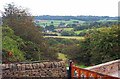

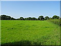
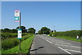
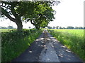

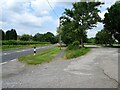
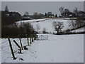
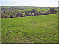
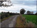
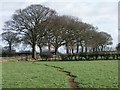
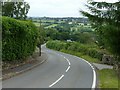
14 photos from this area
Area Information
Key information about the DE7 6DG including its size, population, and administrative classification.
- Area Type
- Postcode
- Area Size
- 1.2 km²
- Population
- 1533
- Population Density
- 208 people/km²
House Prices in DE7 6DG
51
Properties
£641,955
Average Sold Price
£42,000
Lowest Price
£2,200,000
Highest Price
Showing 51 properties
| Address | Type | Beds | Baths | Last Sale Price | Last Sale Date | |
|---|---|---|---|---|---|---|
| Moorecroft, 10 Woodside, Morley, Ilkeston, DE7 6DG | Detached | 4 | 1 | £805,000 | Feb 2025 | |
| 3 Woodside, Morley, Ilkeston, DE7 6DG | house | 4 | 3 | £523,350 | Sep 2024 | |
| 11 Woodside, Morley, Ilkeston, DE7 6DG | Bungalow | - | - | £475,000 | May 2024 | |
| 35 Woodside, Morley, Ilkeston, DE7 6DG | Detached | 5 | 3 | £2,200,000 | Mar 2023 | |
| The Laurels, Main Road, Morley, DE7 6DG | Detached | 4 | - | £640,000 | Jun 2022 | |
| Woodside View, 15 Woodside, Morley, Ilkeston, DE7 6DG | house | - | - | £451,160 | May 2021 | |
| 13 Woodside, Morley, Ilkeston, DE7 6DG | Detached | 6 | 5 | £440,000 | Sep 2019 | |
| 17 Woodside, Morley, Ilkeston, DE7 6DG | house | 4 | - | £765,000 | Jan 2018 | |
| 2 Woodside, Morley, Ilkeston, DE7 6DG | Bungalow | 4 | - | £480,000 | Jul 2015 | |
| The Old Toll House, Main Road, Morley, DE7 6DG | Bungalow | 4 | 2 | £240,000 | Jul 2010 |
Page 1 of 6
Energy Efficiency in DE7 6DG
Amenities
Schools
| Rank | School | Type | Entry gender | Ages |
|---|
Explore more schools in this area
Go to Schools tabDemographics
Household Size
Two person
most common
Accommodation Type
Houses
most common
Tenure
84
majority
Ethnic Group
White
most common
Religion
N/A
most common
Household Composition
N/A
most common
Age
47
median
Adults (30-64 years)
most common
Household Deprivation
N/A
with no deprivation
NS-SEC
40
in Lower managerial occupations
Explore more demographic insights in this area
Go to Demographics tabPlanning
Planning Constraints
- Flood RiskPremium
- Ramsar Wetland SitesPremium
- Area of Outstanding Natural BeautyPremium
- Protected Nature ReservePremium
- Protected WoodlandPremium