Area Overview for DE7 5HS
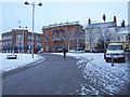
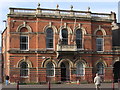
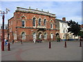
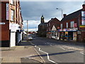
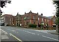
Photos of DE7 5HS


Area Information
Living in DE7 5HS means being part of a densely populated, small residential cluster in England. The area covers just 1.9 hectares, yet it houses 1,764 residents, resulting in a population density of 94,099 people per square kilometre. This compact postcode is characterised by a mature community, with a median age of 47 and a majority of residents aged 30–64. The area is predominantly home-owning, with 59% of properties in private ownership, and most homes are traditional houses. Daily life here is shaped by proximity to essential services, including schools, rail networks, and retail hubs. The absence of significant natural constraints—such as flood zones, protected woodlands, or AONB areas—makes DE7 5HS a practical choice for those prioritising accessibility over scenic landscapes. However, the high crime risk reported in assessments suggests residents should consider security measures. For those seeking a tight-knit community with direct access to infrastructure, DE7 5HS offers a mix of convenience and challenges.
- Area Type
- Postcode
- Area Size
- 1.9 hectares
- Population
- 1764
- Population Density
- 2896 people/km²
The property market in DE7 5HS is dominated by owner-occupied homes, with 59% of properties in private hands. This contrasts with areas where rental markets predominate, indicating a community of long-term residents rather than transient tenants. The accommodation type is predominantly houses, which may appeal to families or individuals seeking more space than flats. Given the area’s small size—just 1.9 hectares—the housing stock is limited, meaning buyers must consider proximity to amenities and transport links. The high population density suggests competition for available properties, particularly for those prioritising proximity to schools and rail networks. For buyers, this means evaluating not only property value but also the practicality of living in a densely populated area with limited expansion potential. The mix of houses and the strong home ownership rate also implies a stable market, though the lack of specific data on property prices or trends leaves gaps in understanding the financial landscape.
House Prices in DE7 5HS
No properties found in this postcode.
Energy Efficiency in DE7 5HS
Daily life in DE7 5HS is shaped by its proximity to retail, dining, and transport hubs. The area’s retail landscape includes notable venues such as Farmfoods Hallam, Heron Hallam, and Aldi Cotmanhay, offering a range of shopping and grocery options. These stores cater to both everyday needs and convenience, reinforcing the area’s practicality. For commuters, the nearby rail stations—Ilkeston, Langley Mill, and Bulwell—provide direct links to surrounding towns and cities, while tram stops like Tram Park & Ride enhance local mobility. The mix of retail, transport, and community-focused amenities suggests a lifestyle that prioritises accessibility over leisure. However, the absence of parks or recreational spaces in the data means the area’s character is defined more by its infrastructure than natural landscapes. Residents must rely on nearby areas for leisure activities, though the existing amenities ensure a functional, if compact, living environment.
Amenities
Schools
Residents of DE7 5HS have access to a range of educational institutions, including Ilkeston School: Specialist Arts College, which serves primary-aged children. Nearby, the Ormiston Ilkeston Enterprise Academy and The Ormiston Ilkeston Academy are both academies, with the former holding a ‘good’ Ofsted rating. This mix of school types provides families with options, from specialist arts-focused education to academies with broader curricula. The presence of two academies suggests a focus on structured, potentially high-achieving educational environments. However, no data on student performance or school capacity is provided, so prospective buyers must verify current enrolment levels and quality of teaching independently. For families prioritising education, the proximity of these schools is a key advantage, though the lack of detailed performance metrics means further research is necessary to assess their suitability.
| Rank | School | Type | Entry gender | Ages |
|---|
Explore more schools in this area
Go to Schools tabDemographics
The community in DE7 5HS is defined by its demographic composition. With a median age of 47, the area skews towards middle-aged adults, particularly those in the 30–64 age range. This suggests a stable population with established careers and family structures. Home ownership is strong, at 59%, indicating a preference for long-term residency over rental properties. The predominant accommodation type is houses, which aligns with the demographic profile of families or individuals seeking more space. The predominant ethnic group is White, though no specific data on diversity or deprivation levels is provided. The high population density—94,099 people per square kilometre—means living in DE7 5HS involves navigating a closely packed environment, which may influence social dynamics and access to shared resources. For prospective buyers, this profile suggests a community with a focus on stability, though the lack of detailed diversity metrics leaves room for further inquiry.
Household Size
Accommodation Type
Tenure
Ethnic Group
Religion
Household Composition
Age
Household Deprivation
NS-SEC
Explore more demographic insights in this area
Go to Demographics tabPlanning
Planning Constraints
- Flood RiskPremium
- Ramsar Wetland SitesPremium
- Area of Outstanding Natural BeautyPremium
- Protected Nature ReservePremium
- Protected WoodlandPremium