Area Overview for DE7 5HL
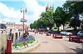
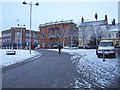
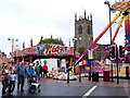
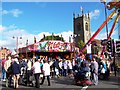
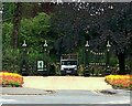
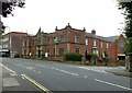
Photos of DE7 5HL


Area Information
Living in DE7 5HL offers a compact, tightly knit residential experience in a small cluster of homes. With a population of 1,311 and a density of 1,157 people per square kilometre, this area is characterised by its close-knit community and straightforward layout. The median age of 47 suggests a mature demographic, with most residents falling within the 30–64 age range. This makes DE7 5HL a place where established families and long-term residents predominate, contributing to a stable and familiar environment. The area’s housing stock is almost entirely composed of houses, with 89% of properties owner-occupied, reinforcing a sense of permanence. Nearby, schools such as St Thomas Catholic Primary and Kirk Hallam Community Academy provide educational options for local families. While the area lacks natural beauty designations or protected landscapes, its proximity to rail and metro services ensures connectivity to larger towns. For those seeking a quiet, residential setting with practical amenities, DE7 5HL balances simplicity with accessibility.
- Area Type
- Postcode
- Area Size
- Not available
- Population
- 1311
- Population Density
- 1157 people/km²
The property market in DE7 5HL is dominated by owner-occupied homes, with 89% of properties in private hands. This suggests a low rental market presence, making the area more appealing to buyers seeking long-term stability rather than short-term investment. The accommodation type is exclusively houses, which contrasts with areas where flats or apartments predominate. This housing stock likely appeals to families or individuals who prefer standalone properties with private gardens or outdoor space. Given the area’s small size and high home ownership, property availability may be limited, and buyers should consider the proximity to nearby towns for additional options. The focus on houses also implies that the market may cater to those prioritising space and privacy over urban convenience.
House Prices in DE7 5HL
No properties found in this postcode.
Energy Efficiency in DE7 5HL
Residents of DE7 5HL have access to a range of amenities within practical reach. Retail options include Farmfoods Hallam, Heron Hallam, and Morrisons Hallam, providing everyday shopping needs. The area’s rail and metro stations—Ilkeston, Langley Mill, and Tram Park & Ride—ensure easy access to nearby towns and employment hubs. While the data does not specify parks or leisure facilities, the proximity to transport links suggests opportunities for recreation in surrounding areas. The combination of retail outlets and transport infrastructure supports a convenient lifestyle, allowing residents to manage daily errands and commute efficiently. This balance of practical amenities and connectivity makes DE7 5HL suitable for those prioritising accessibility over extensive on-site leisure facilities.
Amenities
Schools
Residents of DE7 5HL have access to a range of schools, including St Thomas Catholic Primary, which provides early years and primary education, and Kirk Hallam Community Technology and Sports College, though its primary designation may require verification. Kirk Hallam Community Academy and St Thomas Catholic Voluntary Academy are academies, offering alternative educational frameworks. One Kirk Hallam Community Academy has an Ofsted rating of satisfactory, indicating a moderate standard of performance. The mix of school types allows families to choose between traditional state schools and academies, which may offer specialised curricula or governance models. For parents, this diversity ensures options for different educational preferences, though the quality of individual institutions should be assessed through recent inspections and student outcomes.
| Rank | School | Type | Entry gender | Ages |
|---|
Explore more schools in this area
Go to Schools tabDemographics
DE7 5HL’s population is predominantly composed of adults aged 30–64, with a median age of 47. This suggests a community of established professionals and families, rather than a mix of younger or older demographics. The 89% home ownership rate indicates that most residents are long-term homeowners, which aligns with the area’s focus on houses rather than flats or rental properties. The predominant ethnic group is White, reflecting a homogenous demographic profile. While no specific deprivation data is provided, the high home ownership and stable age distribution imply a relatively secure economic environment. However, the absence of detailed diversity metrics means the community’s full composition remains less defined. The area’s character is shaped by its mature residents, who likely prioritise stability and proximity to essential services such as schools and transport links.
Household Size
Accommodation Type
Tenure
Ethnic Group
Religion
Household Composition
Age
Household Deprivation
NS-SEC
Explore more demographic insights in this area
Go to Demographics tabPlanning
Planning Constraints
- Flood RiskPremium
- Ramsar Wetland SitesPremium
- Area of Outstanding Natural BeautyPremium
- Protected Nature ReservePremium
- Protected WoodlandPremium