Area Overview for DE7 5FD
Photos of DE7 5FD
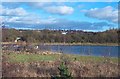
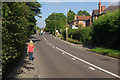
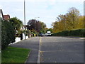

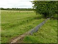
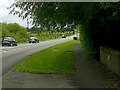
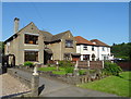
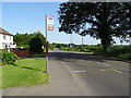
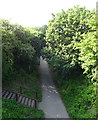
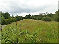
82 photos from this area
Area Information
Key information about the DE7 5FD including its size, population, and administrative classification.
- Area Type
- Postcode
- Area Size
- 14.5 hectares
- Population
- 1311
- Population Density
- 1157 people/km²
House Prices in DE7 5FD
59
Properties
£232,886
Average Sold Price
£75,000
Lowest Price
£477,000
Highest Price
Showing 59 properties
| Address | Type | Beds | Baths | Last Sale Price | Last Sale Date | |
|---|---|---|---|---|---|---|
| 17 Kniveton Park, Ilkeston, DE7 5FD | Retail | 3 | 1 | £363,950 | Oct 2022 | |
| Dunraven, 37 Kniveton Park, Ilkeston, DE7 5FD | house | - | - | £477,000 | Jun 2022 | |
| 22 Kniveton Park, Ilkeston, DE7 5FD | Detached | 5 | 2 | £400,000 | Mar 2022 | |
| 53 Kniveton Park, Ilkeston, DE7 5FD | Retail | 4 | 1 | £375,000 | Mar 2022 | |
| 24 Kniveton Park, Ilkeston, DE7 5FD | Detached | 3 | 1 | £344,000 | Mar 2022 | |
| Westview, 35 Kniveton Park, Ilkeston, DE7 5FD | house | - | - | £320,000 | Jul 2021 | |
| 68 Kniveton Park, Ilkeston, DE7 5FD | Detached | 4 | 3 | £450,000 | Mar 2021 | |
| 1 Kniveton Park, Ilkeston, DE7 5FD | Detached | 4 | 2 | £350,000 | Feb 2021 | |
| The White House, 12 Kniveton Park, Ilkeston, DE7 5FD | Detached | 3 | 1 | £300,040 | Jan 2020 | |
| 70 Kniveton Park, Ilkeston, DE7 5FD | Detached | 3 | 1 | £255,000 | Jun 2019 |
Page 1 of 6
Energy Efficiency in DE7 5FD
Amenities
Schools
| Rank | School | Type | Entry gender | Ages |
|---|
Explore more schools in this area
Go to Schools tabDemographics
Household Size
Two person
most common
Accommodation Type
Houses
most common
Tenure
89
majority
Ethnic Group
White
most common
Religion
N/A
most common
Household Composition
N/A
most common
Age
47
median
Adults (30-64 years)
most common
Household Deprivation
N/A
with no deprivation
NS-SEC
37
in Lower managerial occupations
Explore more demographic insights in this area
Go to Demographics tabPlanning
Planning Constraints
- Flood RiskPremium
- Ramsar Wetland SitesPremium
- Area of Outstanding Natural BeautyPremium
- Protected Nature ReservePremium
- Protected WoodlandPremium