Area Overview for DE7 4QW
Photos of DE7 4QW
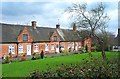
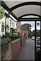
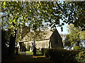
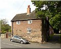

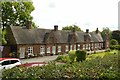

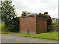
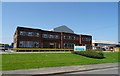
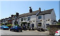
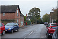
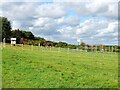
28 photos from this area
Area Information
Key information about the DE7 4QW including its size, population, and administrative classification.
- Area Type
- Postcode
- Area Size
- 66.7 hectares
- Population
- 1201
- Population Density
- 91 people/km²
House Prices in DE7 4QW
9
Properties
£114,167
Average Sold Price
£58,000
Lowest Price
£146,000
Highest Price
Showing 9 properties
| Address | Type | Beds | Baths | Last Sale Price | Last Sale Date | |
|---|---|---|---|---|---|---|
| 3 Littlewell Lane, Stanton By Dale, DE7 4QW | Terraced | 2 | 1 | £146,000 | Nov 2023 | |
| 2 Littlewell Lane, Stanton By Dale, DE7 4QW | Terraced | 2 | 1 | £138,500 | Jun 2020 | |
| 1 Littlewell Lane, Stanton By Dale, DE7 4QW | Industrial | - | - | £58,000 | Nov 2000 | |
| 4 Littlewell Lane, Stanton By Dale, DE7 4QW | Terraced | - | - | - | - | |
| 1, The Forge, Littlewell Lane, Stanton By Dale, DE7 4QW | Industrial | - | - | - | - | |
| Map Ltd, Warehouse, Littlewell Lane, Stanton By Dale, DE7 4QW | office_workshop | - | - | - | - | |
| Eyetee Network Supplies Ltd, 2, The Forge, Littlewell Lane, Stanton By Dale, DE7 4QW | Industrial | - | - | - | - | |
| Hollins And Gee Scaffolding, Land East Side Of, Littlewell Lane, Stanton By Dale, DE7 4QW | warehouse | - | - | - | - | |
| Unit 4, The Foundry, Littlewell Lane, Stanton By Dale, DE7 4QW | office_workshop | - | - | - | - |
Energy Efficiency in DE7 4QW
Amenities
Schools
| Rank | School | Type | Entry gender | Ages |
|---|
Explore more schools in this area
Go to Schools tabDemographics
Household Size
Two person
most common
Accommodation Type
Houses
most common
Tenure
82
majority
Ethnic Group
White
most common
Religion
N/A
most common
Household Composition
N/A
most common
Age
47
median
Adults (30-64 years)
most common
Household Deprivation
N/A
with no deprivation
NS-SEC
40
in Lower managerial occupations
Explore more demographic insights in this area
Go to Demographics tabPlanning
Planning Constraints
- Flood RiskPremium
- Ramsar Wetland SitesPremium
- Area of Outstanding Natural BeautyPremium
- Protected Nature ReservePremium
- Protected WoodlandPremium