Area Overview for DE7 4EX
Photos of DE7 4EX
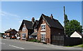
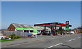
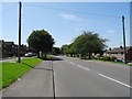
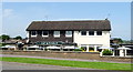
41 photos from this area
Area Information
Key information about the DE7 4EX including its size, population, and administrative classification.
- Area Type
- Postcode
- Area Size
- 1.6 hectares
- Population
- 1652
- Population Density
- 2457 people/km²
House Prices in DE7 4EX
34
Properties
£118,081
Average Sold Price
£37,000
Lowest Price
£195,000
Highest Price
Showing 34 properties
| Address | Type | Beds | Baths | Last Sale Price | Last Sale Date | |
|---|---|---|---|---|---|---|
| 127 Kenilworth Drive, Ilkeston, DE7 4EX | Terraced | 2 | 1 | £153,500 | Aug 2025 | |
| 87 Kenilworth Drive, Ilkeston, DE7 4EX | Semi-detached | 2 | 1 | £135,000 | Jan 2025 | |
| 115 Kenilworth Drive, Ilkeston, DE7 4EX | house | - | - | £145,000 | Feb 2023 | |
| 89 Kenilworth Drive, Ilkeston, DE7 4EX | house | 3 | 1 | £195,000 | Aug 2022 | |
| 105 Kenilworth Drive, Ilkeston, DE7 4EX | Semi-detached | 3 | - | £170,000 | Nov 2021 | |
| 123 Kenilworth Drive, Ilkeston, DE7 4EX | house | - | - | £160,000 | Sep 2021 | |
| 99 Kenilworth Drive, Ilkeston, DE7 4EX | house | 2 | 1 | £141,500 | Jun 2021 | |
| 103 Kenilworth Drive, Ilkeston, DE7 4EX | house | 3 | 1 | £130,000 | May 2021 | |
| 133 Kenilworth Drive, Ilkeston, DE7 4EX | Semi-detached | 3 | 1 | £130,000 | Nov 2019 | |
| 111 Kenilworth Drive, Ilkeston, DE7 4EX | house | 2 | 1 | £79,800 | Apr 2016 |
Page 1 of 4
Energy Efficiency in DE7 4EX
Amenities
Schools
| Rank | School | Type | Entry gender | Ages |
|---|
Explore more schools in this area
Go to Schools tabDemographics
Household Size
Family (3-5 people)
most common
Accommodation Type
Houses
most common
Tenure
67
majority
Ethnic Group
White
most common
Religion
N/A
most common
Household Composition
N/A
most common
Age
47
median
Adults (30-64 years)
most common
Household Deprivation
N/A
with no deprivation
NS-SEC
20
in Lower managerial occupations
Explore more demographic insights in this area
Go to Demographics tabPlanning
Planning Constraints
- Flood RiskPremium
- Ramsar Wetland SitesPremium
- Area of Outstanding Natural BeautyPremium
- Protected Nature ReservePremium
- Protected WoodlandPremium