Area Overview for DE7 2LL
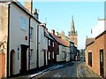
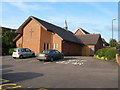
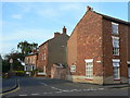
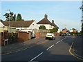
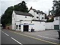
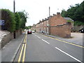
Photos of DE7 2LL


Area Information
Living in DE7 2LL means being part of a small, tightly knit residential cluster in England, where 2,616 residents share a population density of 431 people per square kilometre. This is a modest area, ideal for those seeking a quieter, community-focused lifestyle. The demographic profile suggests a mature population, with a median age of 47 and a majority of residents aged 30–64. Most homes here are owner-occupied, reflecting a stable, long-term presence. Daily life is shaped by proximity to essential services, with five retail outlets nearby, including Co-op Borough and Aldi Station Road, ensuring basic needs are met locally. The area’s compact size fosters a sense of familiarity, though its small footprint means amenities are concentrated within walking or short driving distance. With no major environmental constraints or flood risks, DE7 2LL offers a straightforward, low-stress living environment for those prioritising safety and simplicity.
- Area Type
- Postcode
- Area Size
- Not available
- Population
- 2616
- Population Density
- 431 people/km²
The property market in DE7 2LL is characterised by a high rate of home ownership (81%), with houses making up the predominant accommodation type. This suggests a market skewed towards owner-occupied homes rather than rentals, which may limit availability for buyers seeking alternative tenures. The small residential cluster means the housing stock is limited, and properties are likely to be well-established, reflecting the area’s mature demographic. Buyers should consider that the compact size of the area may mean competition for homes, particularly for those prioritising specific features or locations. The prevalence of houses over flats or apartments also implies a focus on family-friendly or traditional housing, which may appeal to those seeking space and stability. However, the lack of detailed data on property prices or recent market trends means buyers must conduct further local research to assess value.
House Prices in DE7 2LL
No properties found in this postcode.
Energy Efficiency in DE7 2LL
Residents of DE7 2LL have access to a range of nearby amenities, including five retail outlets such as Co-op Borough and Aldi Station Road, ensuring daily shopping needs are met locally. The area’s proximity to three railway stations—East Midlands Parkway, Long Eaton, and Spondon—provides convenient connections to broader regional networks, facilitating travel to nearby towns or cities. While the data does not specify parks or leisure facilities, the presence of multiple retail and transport options suggests a practical, service-oriented lifestyle. The compact nature of the area means amenities are concentrated, reducing the need for long commutes. For those prioritising convenience, the combination of retail access and rail connectivity offers a straightforward, functional approach to daily living.
Amenities
Schools
| Rank | School | Type | Entry gender | Ages |
|---|
Explore more schools in this area
Go to Schools tabDemographics
The community in DE7 2LL is predominantly composed of adults aged 30–64, with a median age of 47. This suggests a population that is largely established, with fewer young families or retirees compared to other areas. Home ownership is high, at 81%, indicating a strong preference for long-term residency over rental properties. The accommodation type is primarily houses, which aligns with the area’s residential character and the presence of a mature demographic. The predominant ethnic group is White, though specific data on diversity or deprivation is not provided. This profile implies a stable, low-turnover community where residents are likely to have built local connections. The absence of detailed diversity metrics means the area’s cultural composition remains unquantified, but the high home ownership rate and age profile suggest a cohesive, settled population.
Household Size
Accommodation Type
Tenure
Ethnic Group
Religion
Household Composition
Age
Household Deprivation
NS-SEC
Explore more demographic insights in this area
Go to Demographics tabPlanning
Planning Constraints
- Flood RiskPremium
- Ramsar Wetland SitesPremium
- Area of Outstanding Natural BeautyPremium
- Protected Nature ReservePremium
- Protected WoodlandPremium