Area Overview for DE7 1FF
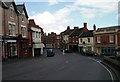
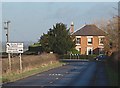
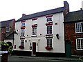
Photos of DE7 1FF


Area Information
Living in DE7 1FF offers a quiet, residential experience with a small cluster of homes catering to a stable community. The area’s population of 1,538 residents, spread across 146 people per square kilometre, reflects a low-density, family-oriented environment. With a median age of 47 and a strong presence of adults aged 30–64, the area is characterised by long-term residents who prioritise stability. Most properties are owner-occupied, with 80% of homes owned by residents, suggesting a tight-knit community with limited rental activity. The postcode is not bound by environmental constraints such as protected woodlands or AONBs, allowing for straightforward development and living. Daily life is shaped by proximity to essential services, including three railway stations and two airports within reach, while the low crime risk score of 88 ensures a sense of security. For those seeking a balanced mix of practicality and tranquillity, DE7 1FF provides a straightforward, unpretentious base for home ownership.
- Area Type
- Postcode
- Area Size
- Not available
- Population
- 1538
- Population Density
- 146 people/km²
The property market in DE7 1FF is dominated by owner-occupied homes, with 80% of properties owned by residents rather than rented. This suggests a stable, long-term market with limited turnover, appealing to those seeking a secure investment. The accommodation type is primarily houses, which are more common than flats or apartments, indicating a traditional, family-friendly housing stock. The small postcode area means properties are likely to be individually distinct, with limited high-density development. For buyers, this translates to a focus on single-family homes, which may be more desirable for those prioritising space and privacy. The lack of rental activity also means competition for properties could be lower, though the small size of the area may limit options. Prospective buyers should consider the local infrastructure, such as nearby rail links, when assessing long-term value.
House Prices in DE7 1FF
No properties found in this postcode.
Energy Efficiency in DE7 1FF
Residents of DE7 1FF have access to a range of nearby amenities, including five retail outlets such as Sainsburys Melbourne, Aldi Chellaston, and Lidl Chellaston, ensuring everyday shopping needs are met. The area’s proximity to three railway stations—Peartree, Willington, and Spondon—offers convenient travel options for commuting or leisure trips. While the postcode itself does not have major parks or recreational spaces, the surrounding region likely provides opportunities for outdoor activities. The presence of two airports, East Midlands Airport, adds to the area’s connectivity, making it easier to travel further afield. The combination of practical retail options and transport links creates a lifestyle that balances convenience with the quietude of a smaller community, ideal for those prioritising accessibility without urban chaos.
Amenities
Schools
| Rank | School | Type | Entry gender | Ages |
|---|
Explore more schools in this area
Go to Schools tabDemographics
The community in DE7 1FF is predominantly composed of adults aged 30–64, with a median age of 47. This suggests a mature, established population, likely with families or long-term careers. Home ownership is high, with 80% of residents owning their properties, indicating a preference for stability over rental living. The area is largely made up of houses, reflecting a traditional, low-density housing stock. The predominant ethnic group is White, which aligns with broader trends in the region. While no specific data on deprivation is provided, the high home ownership rate and low crime risk suggest a relatively secure, self-sufficient community. The absence of younger demographics or transient populations implies a slower pace of change, with residents likely invested in maintaining the area’s character.
Household Size
Accommodation Type
Tenure
Ethnic Group
Religion
Household Composition
Age
Household Deprivation
NS-SEC
Explore more demographic insights in this area
Go to Demographics tabPlanning
Planning Constraints
- Flood RiskPremium
- Ramsar Wetland SitesPremium
- Area of Outstanding Natural BeautyPremium
- Protected Nature ReservePremium
- Protected WoodlandPremium