Area Overview for DE65 6ZQ
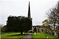
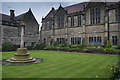
Photos of DE65 6ZQ


Area Information
Living in DE65 6ZQ offers a compact, residential experience shaped by its small cluster of homes and a population of 1,519 people. The area’s density of 310 people per square kilometre suggests a tightly knit community, with homes predominantly in private ownership. This postcode is characterised by a mature demographic, with residents averaging 47 years old and a strong presence of adults aged 30–64. Daily life here is likely quiet and stable, with limited commercial activity but easy access to nearby rail links. The absence of major environmental constraints or flood risks adds to a sense of security, while the proximity to independent schools hints at a focus on education. For buyers seeking a low-maintenance, family-friendly environment with minimal urban pressures, DE65 6ZQ provides a straightforward, grounded alternative to larger towns. Its small scale means amenities are not abundant, but what exists is practical for local needs.
- Area Type
- Postcode
- Area Size
- Not available
- Population
- 1519
- Population Density
- 310 people/km²
DE65 6ZQ is a predominantly owner-occupied area, with 76% of properties in private hands. The housing stock consists mainly of houses, which are typically larger and more suited to families or retirees. This contrasts with rental-heavy areas, where flats or apartments dominate. The small size of the postcode means the property market is limited, with few options available. For buyers, this suggests a niche market where properties are likely to remain in the same hands for decades. The lack of high-density housing also means the area is unlikely to attract speculative investment or rapid price fluctuations. Those seeking a home here may find limited competition but should consider the long-term nature of ownership, given the age profile of residents. The focus on houses also implies a preference for private, low-traffic living over urban convenience.
House Prices in DE65 6ZQ
No properties found in this postcode.
Energy Efficiency in DE65 6ZQ
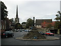
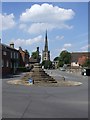
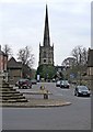
The immediate vicinity of DE65 6ZQ includes five retail outlets, such as Spar, Co-op Repton, and Brobot Petroleum Ltd. These provide basic shopping needs, though the selection is modest, focusing on essentials rather than variety. The area’s small scale means leisure and dining options are limited, with no named restaurants or parks listed in the data. Rail stations like Willington and Peartree offer access to nearby towns for more extensive shopping or entertainment. The lifestyle here is practical, with a focus on convenience over luxury. Residents may find the area ideal for those prioritising quiet living and ease of access to transport over vibrant urban amenities. The retail and transport infrastructure supports a low-maintenance daily routine, though those seeking a bustling social scene may need to look further afield.
Amenities
Schools
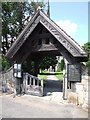
Two independent schools are within reach of DE65 6ZQ: St Wystan’s School and Repton School. Both are private institutions, offering alternatives to state education. Independent schools often provide smaller class sizes, specialist facilities, and a structured environment, which can appeal to families prioritising academic outcomes. However, the absence of state school data means it is unclear whether public options are available nearby. The presence of two independent schools suggests the area may attract families seeking non-state education, though the cost of such schooling is not specified. For those relying on state education, proximity to these schools may not be sufficient, requiring additional research into local public school networks.
| Rank | School | Type | Entry gender | Ages |
|---|
Explore more schools in this area
Go to Schools tabDemographics
The population of DE65 6ZQ is 1,519, with a median age of 47, reflecting a community skewed towards middle-aged and older adults. Over 76% of residents own their homes, a figure significantly higher than the national average, indicating a stable, long-term demographic. The majority of households are adults aged 30–64, suggesting a mix of working professionals and retirees. Housing is predominantly detached or semi-detached homes, aligning with the area’s low density. The predominant ethnic group is White, with no data provided on other groups. The age profile and high home ownership suggest a community with established roots, where property is viewed as a long-term investment. This demographic structure likely shapes local services, with amenities tailored to older adults and families rather than younger populations.
Household Size
Accommodation Type
Tenure
Ethnic Group
Religion
Household Composition
Age
Household Deprivation
NS-SEC
Explore more demographic insights in this area
Go to Demographics tabPlanning
Planning Constraints
- Flood RiskPremium
- Ramsar Wetland SitesPremium
- Area of Outstanding Natural BeautyPremium
- Protected Nature ReservePremium
- Protected WoodlandPremium