Area Overview for DE65 6XR
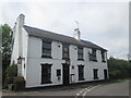
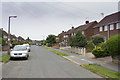
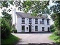
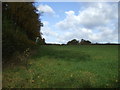
Photos of DE65 6XR


Area Information
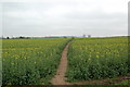
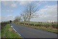
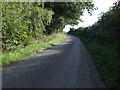
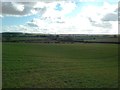
Living in DE65 6XR offers a quiet, low-density residential experience in a small cluster of homes. With a population of 2016 spread across 77 people per square kilometre, the area feels uncluttered, ideal for those seeking a slower pace of life. The community is predominantly composed of adults aged 30–64, many of whom own their homes. Daily life is shaped by proximity to essential services, including a mix of retail outlets and rail links. The area’s safety profile is strong, with a crime risk score of 81/100, reflecting below-average crime rates. Residents benefit from easy access to schools, including Repton Primary School, and nearby rail stations like Willington and Burton, which connect to broader networks. While not a bustling urban hub, DE65 6XR provides a stable, family-oriented environment with minimal environmental risks. Its small size means a tight-knit community feel, where familiarity with local amenities and routines is common. For buyers, it’s a niche market with limited properties, but one that offers security and simplicity.
- Area Type
- Postcode
- Area Size
- Not available
- Population
- 2016
- Population Density
- 77 people/km²
DE65 6XR is a predominantly owner-occupied area, with 79% of homes owned by residents rather than rented. The housing stock consists largely of houses, which is unusual in many modern developments that lean towards flats or apartments. This suggests a market tailored to families or individuals seeking private, spacious living. The small size of the area means property availability is limited, creating a niche market where buyers may face competition. The high home ownership rate indicates a community with long-term residents, which can stabilise property values but may also limit opportunities for new buyers. For those considering the area, the focus on houses implies a need for larger homes, though the immediate surroundings may offer similar options. Buyers should be prepared for a slower-moving market, where properties are likely to remain in the same hands for extended periods.
House Prices in DE65 6XR
No properties found in this postcode.
Energy Efficiency in DE65 6XR
Residents of DE65 6XR enjoy a range of nearby amenities that support daily life. The retail sector includes Spar, Co-op Repton, and Waitrose Little, offering a mix of convenience stores and larger grocery options. These shops provide essentials without requiring long trips to town centres. The area’s rail stations, such as Willington and Burton, add to its connectivity, allowing residents to access cultural, professional, and recreational opportunities beyond the immediate vicinity. While there are no named parks or leisure facilities in the data, the presence of rail links and shops suggests a lifestyle that balances local convenience with regional accessibility. The character of the area is defined by its simplicity—few large-scale developments, but a focus on practicality and proximity to key services. This makes it appealing to those who prioritise ease of living over extensive leisure options.
Amenities
Schools
Residents of DE65 6XR have access to two notable schools within practical reach. Repton Primary School, a state-funded institution with an Ofsted rating of ‘good,’ provides education for younger children, ensuring a solid foundation for local families. Nearby is Repton Preparatory School, an independent institution offering a different educational approach. This combination of state and independent options gives parents flexibility, whether they prioritise affordability or specialised curricula. The presence of both school types suggests a community that values education and is willing to invest in it. For families, the proximity of these schools reduces commuting time and supports a balanced lifestyle. The ‘good’ rating at the primary school adds reassurance about the quality of local education, though independent schools may require additional financial commitment.
| Rank | School | Type | Entry gender | Ages |
|---|
Explore more schools in this area
Go to Schools tabDemographics
The population of DE65 6XR is 2016, with a median age of 47, indicating a mature demographic. The majority of residents are adults aged 30–64, reflecting a community that is largely established and settled. Home ownership is high at 79%, with houses being the predominant type of accommodation. This suggests a stable, long-term resident base rather than a transient population. The ethnic composition is predominantly White, though specific data on other groups is not provided. The low population density of 77 people per square kilometre reinforces the area’s quiet, suburban character. While no deprivation data is available, the high home ownership rate and mature age profile suggest a community with relatively stable economic conditions. This demographic profile aligns with a lifestyle prioritising comfort and continuity over rapid change.
Household Size
Accommodation Type
Tenure
Ethnic Group
Religion
Household Composition
Age
Household Deprivation
NS-SEC
Explore more demographic insights in this area
Go to Demographics tabPlanning
Planning Constraints
- Flood RiskPremium
- Ramsar Wetland SitesPremium
- Area of Outstanding Natural BeautyPremium
- Protected Nature ReservePremium
- Protected WoodlandPremium