Area Overview for DE65 5JY
Photos of DE65 5JY
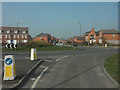
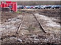
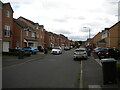
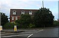
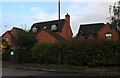
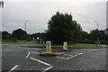
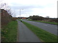
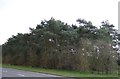
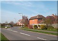
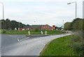
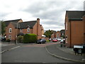
14 photos from this area
Area Information
Key information about the DE65 5JY including its size, population, and administrative classification.
- Area Type
- Postcode
- Area Size
- 2.2 hectares
- Population
- 1605
- Population Density
- 6287 people/km²
House Prices in DE65 5JY
74
Properties
£181,135
Average Sold Price
£89,950
Lowest Price
£373,500
Highest Price
Showing 74 properties
| Address | Type | Beds | Baths | Last Sale Price | Last Sale Date | |
|---|---|---|---|---|---|---|
| 9 Kyle Road, Hilton, Derby, DE65 5JY | Semi-detached | 3 | 2 | £212,500 | Jan 2025 | |
| 20 Kyle Road, Hilton, Derby, DE65 5JY | house | 3 | 2 | £265,000 | Oct 2024 | |
| 35 Kyle Road, Hilton, Derby, DE65 5JY | house | 3 | 2 | £227,000 | Sep 2024 | |
| 28 Kyle Road, Hilton, Derby, DE65 5JY | Semi-detached | 3 | 2 | £200,000 | Apr 2024 | |
| 6 Kyle Road, Hilton, Derby, DE65 5JY | Semi-detached | 3 | 2 | £225,000 | Dec 2023 | |
| 7 Kyle Road, Hilton, Derby, DE65 5JY | Semi-detached | 3 | 2 | £230,000 | Aug 2023 | |
| 54 Kyle Road, Hilton, Derby, DE65 5JY | Semi-detached | 2 | 1 | £180,000 | Jun 2023 | |
| 79 Kyle Road, Hilton, Derby, DE65 5JY | house | - | - | £197,500 | Feb 2023 | |
| 8 Kyle Road, Hilton, Derby, DE65 5JY | Semi-detached | 3 | - | £212,500 | May 2022 | |
| 45 Kyle Road, Hilton, Derby, DE65 5JY | Semi-detached | 3 | - | £212,000 | Sep 2021 |
Page 1 of 8
Energy Efficiency in DE65 5JY
Amenities
Schools
| Rank | School | Type | Entry gender | Ages |
|---|
Explore more schools in this area
Go to Schools tabDemographics
Household Size
Family (3-5 people)
most common
Accommodation Type
Houses
most common
Tenure
81
majority
Ethnic Group
White
most common
Religion
N/A
most common
Household Composition
N/A
most common
Age
47
median
Adults (30-64 years)
most common
Household Deprivation
N/A
with no deprivation
NS-SEC
47
in Lower managerial occupations
Explore more demographic insights in this area
Go to Demographics tabPlanning
Planning Constraints
- Flood RiskPremium
- Ramsar Wetland SitesPremium
- Area of Outstanding Natural BeautyPremium
- Protected Nature ReservePremium
- Protected WoodlandPremium