Area Overview for DE65 5DN
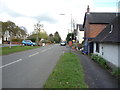
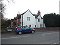
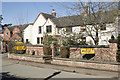
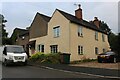
Photos of DE65 5DN


Area Information
Living in DE65 5DN offers a quiet, low-density residential experience in a small cluster of homes spread across 4.4 hectares. With a population of 2,267 and a density of 45 people per square kilometre, the area feels uncluttered, ideal for those seeking a peaceful, community-focused lifestyle. The demographic profile suggests a mature population, with a median age of 47 and the majority of residents aged 30–64. This hints at a stable, established community where many homeowners have lived for years. Daily life here is likely characterised by a slower pace, with local amenities and schools within reach. The area’s small size means it’s not densely packed, offering space without sacrificing access to essential services. For buyers, DE65 5DN presents an opportunity to own a home in a setting that balances tranquillity with practicality, though its limited size means the immediate surroundings are key to understanding full connectivity.
- Area Type
- Postcode
- Area Size
- 4.4 hectares
- Population
- 2267
- Population Density
- 45 people/km²
The property market in DE65 5DN is heavily skewed towards owner-occupation, with 86% of homes owned by residents rather than rented. This indicates a community where long-term residency is common, and property values may reflect this stability. The accommodation type is predominantly houses, which contrasts with areas dominated by flats or apartments. This suggests a market suited to families or individuals seeking more space, though the small area size means the housing stock is limited. Buyers should consider that the immediate surroundings will determine the full range of property options, as the postcode covers only a small cluster of homes. The high home ownership rate may also mean competition for available properties, particularly for those seeking established homes in a low-density setting.
House Prices in DE65 5DN
Showing 1 properties
| Address | Type | Beds | Baths | Last Sale Price | Last Sale Date | |
|---|---|---|---|---|---|---|
| Time For Teeth Ltd, Dentist, Hm Prison And Young Offenders Institute Foston Hall, Uttoxeter Road, Foston, Derby, DE65 5DN | commercial | - | - | - | - |
Energy Efficiency in DE65 5DN
The lifestyle in DE65 5DN is shaped by its small size and the amenities within practical reach. Retail options include five venues, such as Co-op Hatton, Co-op Rolleston-On, and Tesco Hilton, providing everyday shopping convenience. These stores cater to local needs, though the area lacks larger supermarkets or specialty shops. Rail access to Tutbury & Hatton and Uttoxeter stations adds connectivity, enabling travel to nearby towns for more extensive shopping or leisure. While parks or recreational spaces are not explicitly listed, the low population density suggests open spaces may be available. The character of daily life here is likely defined by simplicity and proximity to essential services, with a focus on practicality over luxury. Residents may find the amenities sufficient for basic needs but should consider nearby towns for broader leisure or entertainment options.
Amenities
Schools
Residents of DE65 5DN have access to two primary schools: Long Lane Church of England Primary School and Church Broughton CofE Primary School. Both are primary-level institutions, with the latter holding a ‘good’ Ofsted rating. This mix of schools provides options for families, though the absence of secondary schools means proximity to larger educational institutions will be a key consideration. The presence of two primary schools within the area suggests a focus on early education, which is beneficial for young families. However, the lack of data on secondary schools or higher education facilities means buyers should research nearby towns for comprehensive schooling. The ‘good’ rating at Church Broughton CofE Primary School indicates a reliable standard of education, which could be a deciding factor for families prioritising school quality.
| Rank | School | Type | Entry gender | Ages |
|---|
Explore more schools in this area
Go to Schools tabDemographics
The community in DE65 5DN is predominantly composed of adults aged 30–64, with a median age of 47. This suggests a mature, settled population, likely with long-term ties to the area. Home ownership is high at 86%, indicating a strong sense of stability and investment in local property. The accommodation type is primarily houses, reflecting a preference for family homes or larger dwellings. The predominant ethnic group is White, and no specific data on diversity or deprivation is provided, though the high home ownership rate may correlate with economic security. The age profile suggests a community with a mix of professionals, retirees, and families, potentially creating a balanced social environment. With no mention of deprivation metrics, the focus remains on the demographic traits that shape daily life, such as the presence of primary schools and local amenities.
Household Size
Accommodation Type
Tenure
Ethnic Group
Religion
Household Composition
Age
Household Deprivation
NS-SEC
Explore more demographic insights in this area
Go to Demographics tabPlanning
Planning Constraints
- Flood RiskPremium
- Ramsar Wetland SitesPremium
- Area of Outstanding Natural BeautyPremium
- Protected Nature ReservePremium
- Protected WoodlandPremium