Area Overview for DE65 5AR
Photos of DE65 5AR
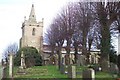
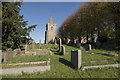
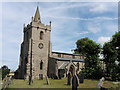
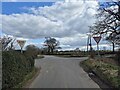

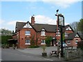
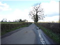
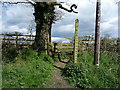
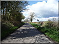
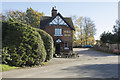
14 photos from this area
Area Information
Key information about the DE65 5AR including its size, population, and administrative classification.
- Area Type
- Postcode
- Area Size
- 16.7 hectares
- Population
- 2267
- Population Density
- 45 people/km²
House Prices in DE65 5AR
34
Properties
£183,996
Average Sold Price
£50,000
Lowest Price
£399,950
Highest Price
Showing 34 properties
| Address | Type | Beds | Baths | Last Sale Price | Last Sale Date | |
|---|---|---|---|---|---|---|
| Three Ways, Boggy Lane, Church Broughton, Derby, DE65 5AR | Cottage | 4 | - | £399,950 | Aug 2021 | |
| 6 Boggy Lane, Church Broughton, Derby, DE65 5AR | Terraced | 2 | 1 | £141,000 | Feb 2021 | |
| 10 Boggy Lane, Church Broughton, Derby, DE65 5AR | house | 3 | 2 | £219,500 | Mar 2020 | |
| Marsh Cottage, Boggy Lane, Church Broughton, Derby, DE65 5AR | house | - | - | £222,500 | Mar 2016 | |
| 1, Rose Cottage, Boggy Lane, Church Broughton, Derby, DE65 5AR | house | - | - | £275,000 | Jan 2014 | |
| Honeysuckle Cottage, Boggy Lane, Church Broughton, Derby, DE65 5AR | Cottage | 3 | 2 | £175,000 | Jul 2006 | |
| 8, The Etchells, Boggy Lane, Church Broughton, Derby, DE65 5AR | Maisonette | 2 | 1 | £120,000 | Dec 2002 | |
| 11 Boggy Lane, Church Broughton, Derby, DE65 5AR | Detached | 5 | 2 | £104,000 | Sep 2000 | |
| Corner Cottage, Boggy Lane, Church Broughton, Derby, DE65 5AR | Detached | - | - | £220,000 | Dec 1999 | |
| Ivy Cottage, Boggy Lane, Church Broughton, Derby, DE65 5AR | Detached | - | - | £110,000 | Jul 1999 |
Page 1 of 4
Energy Efficiency in DE65 5AR
Amenities
Schools
| Rank | School | Type | Entry gender | Ages |
|---|
Explore more schools in this area
Go to Schools tabDemographics
Household Size
Two person
most common
Accommodation Type
Houses
most common
Tenure
86
majority
Ethnic Group
White
most common
Religion
N/A
most common
Household Composition
N/A
most common
Age
47
median
Adults (30-64 years)
most common
Household Deprivation
N/A
with no deprivation
NS-SEC
41
in Lower managerial occupations
Explore more demographic insights in this area
Go to Demographics tabPlanning
Planning Constraints
- Flood RiskPremium
- Ramsar Wetland SitesPremium
- Area of Outstanding Natural BeautyPremium
- Protected Nature ReservePremium
- Protected WoodlandPremium