Area Overview for DE6 6HY
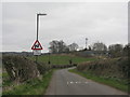
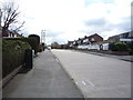
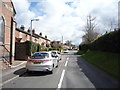
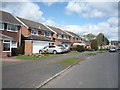
Photos of DE6 6HY


Area Information
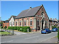
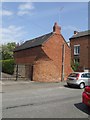
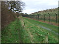
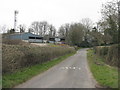
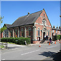
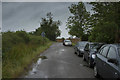
Living in DE6 6HY means residing in a small, semi-rural village in Derbyshire with a population of 1,764 and a population density of 858 people per square kilometre. This postcode area, part of the village of Etwall, retains a village feel despite post-war housing growth. The area is defined by historic features such as St Helen’s Church and Sir John Port Almshouses, which sit on a sand outcrop with good water supplies. Etwall’s character is shaped by its quiet, attractive village centre, footpaths for walking, and a well dressing festival in May. Proximity to the A50 and nearby rail stations like Willington and Tutbury & Hatton offer connectivity to surrounding towns. The village’s semi-rural nature, combined with modern amenities like Waitrose and Aldi, creates a balance between tranquillity and convenience. With a median age of 47 and a population skewed toward adults aged 30–64, DE6 6HY is a community rooted in tradition but accessible to those seeking a slower pace of life.
- Area Type
- Postcode
- Area Size
- Not available
- Population
- 1764
- Population Density
- 858 people/km²
The property market in DE6 6HY is characterised by a high rate of home ownership (75%) and a predominance of houses. This suggests a mix of semi-detached and detached properties, typical of semi-rural areas with limited high-density development. The small size of the postcode area means the housing stock is likely limited, with properties concentrated in the village and surrounding clusters. Given the high ownership rate, the market is primarily owner-occupied rather than rental-focused, which may appeal to buyers seeking stability. The presence of historic homes like the Sir John Port Almshouses adds to the area’s charm, though property values may reflect the village’s semi-rural character. Buyers should consider the proximity to amenities like the A50 and rail stations, which enhance connectivity despite the small footprint of the area.
House Prices in DE6 6HY
No properties found in this postcode.
Energy Efficiency in DE6 6HY
Life in DE6 6HY is enriched by a mix of historic charm and practical amenities. The village centre features St Helen’s Church, Sir John Port Almshouses, and a well dressing festival in May, offering cultural and social events. Nearby retail options include Waitrose Little, Spar, and Aldi, providing everyday shopping needs. The area’s footpaths link to Mickleover, encouraging walking and outdoor activities. Rail stations like Willington and Tutbury & Hatton offer access to regional services, while the A50 ensures connectivity to larger towns. The semi-rural setting allows for a peaceful lifestyle, complemented by the proximity of the Toyota car factory to the south. This blend of heritage, convenience, and natural surroundings makes DE6 6HY appealing to those seeking a balanced, community-focused environment.
Amenities
Schools
Residents of DE6 6HY have access to a range of schools, including Etwall Primary School, which holds a ‘good’ Ofsted rating, and John Port Spencer Academy, an academy with the same rating. Two other schools, John Port School (primary) and another John Port School (academy), are listed but lack Ofsted ratings in the data. The presence of both primary and academy schools provides families with options, though the absence of detailed ratings for some institutions may require further investigation. The ‘good’ ratings at Etwall Primary and John Port Spencer Academy suggest a strong educational foundation, which is a key consideration for families prioritising school quality. The proximity of these schools to the village centre ensures ease of access, reinforcing the area’s appeal for households with children.
| Rank | School | Type | Entry gender | Ages |
|---|
Explore more schools in this area
Go to Schools tabDemographics
The community in DE6 6HY is predominantly composed of adults aged 30–64, with a median age of 47. Home ownership is high, at 75%, suggesting a stable, long-term resident base. The accommodation type is primarily houses, indicating a mix of semi-detached and detached properties typical of rural and semi-rural areas. The predominant ethnic group is White, reflecting the broader demographic trends in Derbyshire. The population density of 858 people per square kilometre suggests a compact, closely knit community. With no specific deprivation data provided, the area’s safety and low crime risk (score 89/100) likely contribute to a high quality of life. The age profile and ownership rates imply a mature, settled population, though the lack of younger households may influence local services and amenities.
Household Size
Accommodation Type
Tenure
Ethnic Group
Religion
Household Composition
Age
Household Deprivation
NS-SEC
Explore more demographic insights in this area
Go to Demographics tabPlanning
Planning Constraints
- Flood RiskPremium
- Ramsar Wetland SitesPremium
- Area of Outstanding Natural BeautyPremium
- Protected Nature ReservePremium
- Protected WoodlandPremium