Area Overview for DE6 5JS
Photos of DE6 5JS
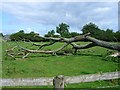
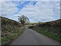
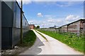

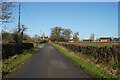
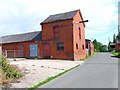
7 photos from this area
Area Information
Key information about the DE6 5JS including its size, population, and administrative classification.
- Area Type
- Postcode
- Area Size
- 1.8 km²
- Population
- 2683
- Population Density
- 83 people/km²
House Prices in DE6 5JS
20
Properties
£374,000
Average Sold Price
£98,000
Lowest Price
£650,000
Highest Price
Showing 20 properties
| Address | Type | Beds | Baths | Last Sale Price | Last Sale Date | |
|---|---|---|---|---|---|---|
| The Woodyard, 2 Old Marston Lane, Doveridge, DE6 5JS | Detached | 3 | 2 | £650,000 | Jun 2018 | |
| Ivy House, Marston Lane, Doveridge, DE6 5JS | Detached | - | - | £98,000 | Aug 1995 | |
| Woodland Cottage, Marston Lane, Doveridge, DE6 5JS | Detached | - | - | - | - | |
| Clinton Eggs, Lordlea Farm, Marston Lane, Doveridge, DE6 5JS | Farm | - | - | - | - | |
| Holmlea Farm Bungalow, Marston Lane, Doveridge, DE6 5JS | Detached | - | - | - | - | |
| Pingle Barn, Doveridge Fields Farm, Marston Lane, Doveridge, DE6 5JS | Bungalow | 4 | - | - | - | |
| Dovelin Cars, Victory Farm, 10 Marston Lane, Doveridge, DE6 5JS | Retail | - | - | - | - | |
| Barn North East Of Holmlea Farm Bungalow, Marston Lane, Doveridge, DE6 5JS | Farm | - | - | - | - | |
| Mill House, Doveridge Fields Farm, Marston Lane, Doveridge, DE6 5JS | house | 3 | - | - | - | |
| Lordlea Farm, Marston Lane, Doveridge, DE6 5JS | Detached | - | - | - | - |
Page 1 of 2
Energy Efficiency in DE6 5JS
Amenities
Schools
| Rank | School | Type | Entry gender | Ages |
|---|
Explore more schools in this area
Go to Schools tabDemographics
Household Size
Two person
most common
Accommodation Type
Houses
most common
Tenure
77
majority
Ethnic Group
White
most common
Religion
N/A
most common
Household Composition
N/A
most common
Age
47
median
Adults (30-64 years)
most common
Household Deprivation
N/A
with no deprivation
NS-SEC
34
in Lower managerial occupations
Explore more demographic insights in this area
Go to Demographics tabPlanning
Planning Constraints
- Flood RiskPremium
- Ramsar Wetland SitesPremium
- Area of Outstanding Natural BeautyPremium
- Protected Nature ReservePremium
- Protected WoodlandPremium