Area Overview for DE6 4NA
Photos of DE6 4NA
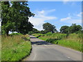
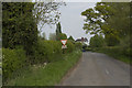
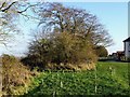
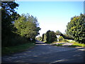
19 photos from this area
Area Information
Key information about the DE6 4NA including its size, population, and administrative classification.
- Area Type
- Postcode
- Area Size
- 71.9 hectares
- Population
- 1283
- Population Density
- 1351 people/km²
House Prices in DE6 4NA
9
Properties
£302,667
Average Sold Price
£18,000
Lowest Price
£640,000
Highest Price
Showing 9 properties
| Address | Type | Beds | Baths | Last Sale Price | Last Sale Date | |
|---|---|---|---|---|---|---|
| White Cottage, Radbourne Common, Dalbury Lees, Ashbourne, DE6 4NA | house | - | - | £640,000 | Jul 2021 | |
| Holly Cottage, Radbourne Common, Dalbury Lees, Ashbourne, DE6 4NA | Semi-detached | 3 | 2 | £18,000 | Dec 2018 | |
| Linden Tree, Radbourne Common, Dalbury Lees, Ashbourne, DE6 4NA | house | - | - | £250,000 | Nov 1999 | |
| Granny Annexe, Linden Tree, Radbourne Common, Dalbury Lees, Ashbourne, DE6 4NA | Semi-detached | - | - | - | - | |
| Loafers, Radbourne Common, Dalbury Lees, Ashbourne, DE6 4NA | Detached | - | - | - | - | |
| Honeysuckle Cottage, Radbourne Common, Dalbury Lees, Ashbourne, DE6 4NA | house | - | - | - | - | |
| Ivy House Farm, Radbourne Common, Dalbury Lees, Ashbourne, DE6 4NA | Detached | - | - | - | - | |
| Hackwood Cottage, Radbourne Common, Dalbury Lees, Ashbourne, DE6 4NA | Cottage | 3 | - | - | - | |
| Brickyard Wood Farm, Radbourne Common, Dalbury Lees, Ashbourne, DE6 4NA | Semi-detached | - | - | - | - |
Energy Efficiency in DE6 4NA
Amenities
Schools
| Rank | School | Type | Entry gender | Ages |
|---|
Explore more schools in this area
Go to Schools tabDemographics
Household Size
Family (3-5 people)
most common
Accommodation Type
Houses
most common
Tenure
79
majority
Ethnic Group
White
most common
Religion
N/A
most common
Household Composition
N/A
most common
Age
47
median
Adults (30-64 years)
most common
Household Deprivation
N/A
with no deprivation
NS-SEC
51
in Lower managerial occupations
Explore more demographic insights in this area
Go to Demographics tabPlanning
Planning Constraints
- Flood RiskPremium
- Ramsar Wetland SitesPremium
- Area of Outstanding Natural BeautyPremium
- Protected Nature ReservePremium
- Protected WoodlandPremium