Area Overview for DE6 1PN
Photos of DE6 1PN
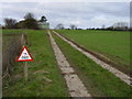


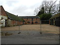

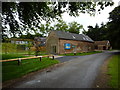
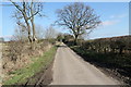


14 photos from this area
Area Information
Key information about the DE6 1PN including its size, population, and administrative classification.
- Area Type
- Postcode
- Area Size
- 1.2 km²
- Population
- 1844
- Population Density
- 41 people/km²
House Prices in DE6 1PN
21
Properties
£549,400
Average Sold Price
£180,000
Lowest Price
£1,080,000
Highest Price
Showing 21 properties
| Address | Type | Beds | Baths | Last Sale Price | Last Sale Date | |
|---|---|---|---|---|---|---|
| Brookfields, Pinfold Lane, Bradley, DE6 1PN | house | 4 | 2 | £800,000 | Sep 2023 | |
| Brook Farm, Pinfold Lane, Bradley, DE6 1PN | Detached | 7 | 2 | £1,080,000 | Sep 2021 | |
| Pinfold Cottage, Pinfold Lane, Bradley, DE6 1PN | house | - | - | £180,000 | Aug 2021 | |
| Thrashers Barn, Pinfold Lane, Bradley, DE6 1PN | house | 5 | - | £840,000 | Jun 2021 | |
| Beechmount, Pinfold Lane, Bradley, DE6 1PN | Detached | 7 | 6 | £350,000 | Nov 2020 | |
| De Ferrers Barn, Pinfold Lane, Bradley, DE6 1PN | Farm | 4 | - | £520,000 | Nov 2013 | |
| Casa Maria, Pinfold Lane, Bradley, DE6 1PN | Bungalow | 3 | - | £359,000 | Sep 2013 | |
| Old Peak Barn, Pinfold Lane, Bradley, DE6 1PN | Terraced | - | - | £570,000 | Jul 2013 | |
| The Brook House, Pinfold Lane, Bradley, DE6 1PN | house | 4 | - | £545,000 | Sep 2010 | |
| Jobs Wood, Pinfold Lane, Bradley, DE6 1PN | Detached | - | - | £249,999 | Sep 2002 |
Page 1 of 3
Energy Efficiency in DE6 1PN
Amenities
Schools
| Rank | School | Type | Entry gender | Ages |
|---|
Explore more schools in this area
Go to Schools tabDemographics
Household Size
Two person
most common
Accommodation Type
Houses
most common
Tenure
74
majority
Ethnic Group
White
most common
Religion
N/A
most common
Household Composition
N/A
most common
Age
47
median
Adults (30-64 years)
most common
Household Deprivation
N/A
with no deprivation
NS-SEC
42
in Lower managerial occupations
Explore more demographic insights in this area
Go to Demographics tabPlanning
Planning Constraints
- Flood RiskPremium
- Ramsar Wetland SitesPremium
- Area of Outstanding Natural BeautyPremium
- Protected Nature ReservePremium
- Protected WoodlandPremium