Area Overview for DE6 1HT
Photos of DE6 1HT
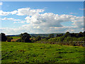
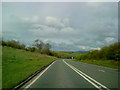
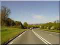

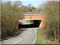
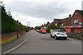
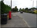
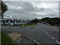
19 photos from this area
Area Information
Key information about the DE6 1HT including its size, population, and administrative classification.
- Area Type
- Postcode
- Area Size
- 1.0 hectares
- Population
- 2134
- Population Density
- 1858 people/km²
House Prices in DE6 1HT
29
Properties
£153,143
Average Sold Price
£59,500
Lowest Price
£245,000
Highest Price
Showing 29 properties
| Address | Type | Beds | Baths | Last Sale Price | Last Sale Date | |
|---|---|---|---|---|---|---|
| 27 Chestnut Drive, Ashbourne, DE6 1HT | Semi-detached | 3 | 1 | £245,000 | Aug 2025 | |
| 21 Chestnut Drive, Ashbourne, DE6 1HT | Semi-detached | 3 | 1 | £185,000 | Mar 2018 | |
| 15 Chestnut Drive, Ashbourne, DE6 1HT | Semi-detached | 3 | 1 | £205,000 | Dec 2016 | |
| 13 Chestnut Drive, Ashbourne, DE6 1HT | house | 3 | - | £160,000 | Jul 2012 | |
| 24 Chestnut Drive, Ashbourne, DE6 1HT | Terraced | - | - | £156,000 | Jun 2008 | |
| 11 Chestnut Drive, Ashbourne, DE6 1HT | Terraced | - | - | £59,500 | Feb 2000 | |
| 22 Chestnut Drive, Ashbourne, DE6 1HT | Semi-detached | 3 | 1 | £61,500 | Jan 2000 | |
| 2 Chestnut Drive, Ashbourne, DE6 1HT | Semi-detached | 3 | 1 | - | - | |
| 5 Chestnut Drive, Ashbourne, DE6 1HT | house | 3 | 1 | - | - | |
| 4 Chestnut Drive, Ashbourne, DE6 1HT | house | 5 | 1 | - | - |
Page 1 of 3
Energy Efficiency in DE6 1HT
Amenities
Schools
| Rank | School | Type | Entry gender | Ages |
|---|
Explore more schools in this area
Go to Schools tabDemographics
Household Size
Family (3-5 people)
most common
Accommodation Type
Houses
most common
Tenure
78
majority
Ethnic Group
White
most common
Religion
N/A
most common
Household Composition
N/A
most common
Age
47
median
Adults (30-64 years)
most common
Household Deprivation
N/A
with no deprivation
NS-SEC
34
in Lower managerial occupations
Explore more demographic insights in this area
Go to Demographics tabPlanning
Planning Constraints
- Flood RiskPremium
- Ramsar Wetland SitesPremium
- Area of Outstanding Natural BeautyPremium
- Protected Nature ReservePremium
- Protected WoodlandPremium