Area Overview for DE6 1BW
Photos of DE6 1BW
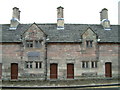
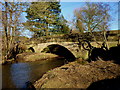
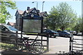


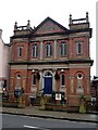
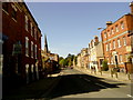
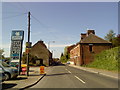
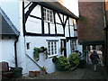
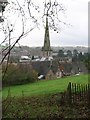

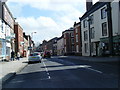
100 photos from this area
Area Information
Key information about the DE6 1BW including its size, population, and administrative classification.
- Area Type
- Postcode
- Area Size
- 2.3 hectares
- Population
- 1762
- Population Density
- 2622 people/km²
House Prices in DE6 1BW
9
Properties
£130,000
Average Sold Price
£130,000
Lowest Price
£130,000
Highest Price
Showing 9 properties
| Address | Type | Beds | Baths | Last Sale Price | Last Sale Date | |
|---|---|---|---|---|---|---|
| 3 King Edward Street, Ashbourne, DE6 1BW | Semi-detached | 2 | 1 | £130,000 | Apr 2022 | |
| Henmore Bank, King Edward Street, Ashbourne, DE6 1BW | Detached | 3 | 2 | - | - | |
| 2, The Courtyard, King Edward Street, Ashbourne, DE6 1BW | Bungalow | 3 | 2 | - | - | |
| 1, The Courtyard, King Edward Street, Ashbourne, DE6 1BW | Bungalow | 3 | 2 | - | - | |
| 5 King Edward Street, Ashbourne, DE6 1BW | Terraced | 3 | 2 | - | - | |
| 2 And 3 Livery House, The Station Hotel, Station Road, Ashbourne, DE6 1BW | undefined | - | - | - | - | |
| Ashbourne Chiropractic Centre, Compton Offices, King Edward Street, Ashbourne, DE6 1BW | Office | - | - | - | - | |
| National Farmers Union, Compton Offices, King Edward Street, Ashbourne, DE6 1BW | Office | - | - | - | - | |
| Voluntary And Community Services Peaks And Dales, Voluntary And Community Services, Compton Offices, King Edward Street, Ashbourne, DE6 1BW | Office | - | - | - | - |
Energy Efficiency in DE6 1BW
Amenities
Schools
| Rank | School | Type | Entry gender | Ages |
|---|
Explore more schools in this area
Go to Schools tabDemographics
Household Size
One person
most common
Accommodation Type
Houses
most common
Tenure
55
majority
Ethnic Group
White
most common
Religion
N/A
most common
Household Composition
N/A
most common
Age
47
median
Adults (30-64 years)
most common
Household Deprivation
N/A
with no deprivation
NS-SEC
29
in Lower managerial occupations
Explore more demographic insights in this area
Go to Demographics tabPlanning
Planning Constraints
- Flood RiskPremium
- Ramsar Wetland SitesPremium
- Area of Outstanding Natural BeautyPremium
- Protected Nature ReservePremium
- Protected WoodlandPremium