Area Overview for DE56 4ZZ
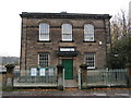
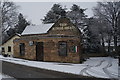
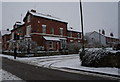
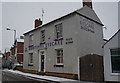
Photos of DE56 4ZZ
Area Information
Living in DE56 4ZZ offers a quiet, compact residential experience in a small cluster of homes. With a population of 1,568 and a density of 411 people per square kilometre, the area is tightly knit, fostering a sense of familiarity among residents. The median age of 47 suggests a mature community, with the majority of residents falling between 30 and 64 years old. This demographic profile indicates a stable, established population, likely with strong local ties. The area’s small size means daily life is conveniently centred around nearby amenities, from shops to transport links. While not a sprawling suburb, DE56 4ZZ balances residential comfort with practical access to essential services, making it appealing for those seeking a low-maintenance, community-focused lifestyle. The absence of major planning constraints or environmental restrictions further adds to its appeal, allowing for straightforward living without the complexities of protected landscapes or flood-prone zones.
- Area Type
- Postcode
- Area Size
- Not available
- Population
- 1568
- Population Density
- 411 people/km²
The property market in DE56 4ZZ is characterised by high home ownership, with 75% of residents living in their own homes. The accommodation type is predominantly houses, which is typical for a small, residential postcode area. This suggests a market that favours owner-occupation over rental properties, likely due to the area’s compact size and established community. The limited number of properties means the housing stock is not extensive, and buyers should consider the local market’s tightness when exploring options. The focus on houses rather than flats or apartments indicates a preference for traditional, family-sized homes. For buyers, this means a limited but potentially stable market, where properties are likely to retain value due to the area’s low environmental and planning risks. However, the small size of the area may restrict the range of available properties, requiring buyers to look closely at nearby postcodes for more options.
House Prices in DE56 4ZZ
No properties found in this postcode.
Energy Efficiency in DE56 4ZZ
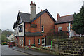
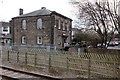
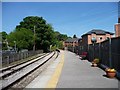
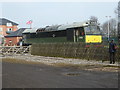
Residents of DE56 4ZZ have access to a range of local amenities within practical reach. Retail options include Co-op Duffield, Co-op Little, and Morrisons Daily, offering everyday shopping needs. The area is also served by multiple rail stations, such as Duffield, Belper, and Derby, which provide easy access to larger towns and cities. The nearby Idridgehay metro station further enhances connectivity, though its single presence limits local public transport options. For leisure and convenience, the proximity to these services supports a lifestyle that balances daily essentials with regional mobility. The absence of major parks or recreational areas is not noted in the data, but the presence of retail and transport hubs suggests a community focused on practicality over expansive leisure facilities. This makes DE56 4ZZ suitable for those prioritising accessibility and routine over large-scale amenities.
Amenities
Schools
| Rank | School | Type | Entry gender | Ages |
|---|
Explore more schools in this area
Go to Schools tabDemographics
The community in DE56 4ZZ is predominantly composed of adults aged 30 to 64, reflecting a mature, settled population. With a median age of 47, the area lacks the presence of younger families or retirees in significant numbers. Home ownership is high, at 75%, indicating a stable housing market where most residents live in their own homes rather than renting. The accommodation type is primarily houses, which aligns with the area’s small, residential character. The predominant ethnic group is White, with no specific data provided on other demographics. This homogeneity may contribute to a cohesive community dynamic. The lack of detailed diversity data means the area’s cultural mix remains less defined, but the high home ownership rate and age profile suggest a population prioritising stability and long-term residency over transient living.
Household Size
Accommodation Type
Tenure
Ethnic Group
Religion
Household Composition
Age
Household Deprivation
NS-SEC
Explore more demographic insights in this area
Go to Demographics tabPlanning
Planning Constraints
- Flood RiskPremium
- Ramsar Wetland SitesPremium
- Area of Outstanding Natural BeautyPremium
- Protected Nature ReservePremium
- Protected WoodlandPremium