Area Overview for DE56 4GS
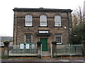
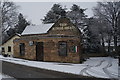
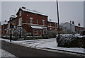
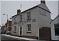
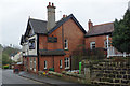
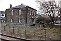
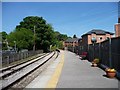
Photos of DE56 4GS

Area Information
Living in DE56 4GS means inhabiting a compact residential cluster in England’s Derbyshire countryside. With a population of 1,649 spread over 1.2 hectares, this area is densely populated yet retains a small-town character. The median age of 47 suggests a stable community, with most residents aged between 30 and 64. Daily life here balances suburban convenience with rural proximity, offering access to local schools, rail links, and retail hubs. The high home ownership rate—88%—indicates a community of long-term residents, many of whom live in family homes. While the area lacks natural conservation designations, its practical amenities and transport options make it appealing for commuters. However, the critical flood risk score of 54.51 necessitates caution, particularly for those considering property near waterways. Despite this, the low crime risk—90 out of 100—suggests a generally safe environment. DE56 4GS is a place where practicality meets tradition, ideal for those seeking a settled, community-focused lifestyle with easy access to nearby towns.
- Area Type
- Postcode
- Area Size
- 1.2 hectares
- Population
- 1649
- Population Density
- 1260 people/km²
The property market in DE56 4GS is dominated by owner-occupied homes, with 88% of residents living in properties they own. This high home ownership rate suggests a community of long-term residents rather than a transient rental market. The accommodation type is predominantly houses, not flats, which is typical for suburban areas with limited high-density development. Given the small area size of 1.2 hectares, the housing stock is likely limited to a few hundred properties, many of which may be family homes. Buyers should consider the proximity to nearby towns, as the immediate surroundings may offer additional housing options. The presence of rail stations within practical reach—such as Duffield, Belper, and Derby—makes this area attractive for commuters. However, the critical flood risk score of 54.51 could affect property desirability and insurance costs, requiring careful due diligence for potential buyers.
House Prices in DE56 4GS
No properties found in this postcode.
Energy Efficiency in DE56 4GS
Residents of DE56 4GS have access to a range of nearby amenities that support a practical, suburban lifestyle. Retail options include Co-op Duffield, Co-op Little, and Waitrose Little, providing everyday shopping needs. The area’s rail stations—Duffield, Belper, and Derby—offer easy access to larger towns, while the Idridgehay metro stop adds further connectivity. Though the area itself is small, the surrounding region likely includes parks and leisure facilities, though these are not explicitly listed in the data. The presence of multiple retail outlets and transport links suggests a convenience-focused lifestyle, ideal for those who value accessibility over sprawling green spaces. For families, the combination of schools and shops creates a self-contained environment, though outdoor recreation may require travel to nearby areas.
Amenities
Schools
Residents of DE56 4GS have access to three notable schools within practical reach. Duffield the Meadows Primary School is a primary school with an Ofsted rating of “good,” offering a reliable option for younger children. The Ecclesbourne School serves both as a primary school and an academy, with the latter also holding a “good” Ofsted rating. This mix of school types provides families with choices, whether they prefer a traditional primary setting or an academy model. The presence of two schools with “good” ratings suggests a strong educational foundation in the area, though parents may need to consider travel times for secondary education, as no secondary schools are explicitly listed. For families prioritising school quality, the proximity of these institutions is a key advantage, supporting a stable, education-focused lifestyle.
| Rank | School | Type | Entry gender | Ages |
|---|
Explore more schools in this area
Go to Schools tabDemographics
DE56 4GS has a median age of 47, with the most common age group being adults aged 30–64. This reflects a mature, stable population, likely composed of families and long-term residents. The 88% home ownership rate underscores a community where most properties are owner-occupied, rather than rented. Accommodation is predominantly houses, not flats, which aligns with the area’s suburban character. The predominant ethnic group is White, indicating a relatively homogeneous demographic profile. With a population density of 1,260 people per square kilometre, the area is compact but not overcrowded. This density supports local amenities and services, though it may limit green space. The absence of significant deprivation data suggests a relatively stable economic environment, though the high flood risk score of 54.51 could impact property values and insurance costs. Overall, the area caters to a settled, middle-aged population with established roots.
Household Size
Accommodation Type
Tenure
Ethnic Group
Religion
Household Composition
Age
Household Deprivation
NS-SEC
Explore more demographic insights in this area
Go to Demographics tabPlanning
Planning Constraints
- Flood RiskPremium
- Ramsar Wetland SitesPremium
- Area of Outstanding Natural BeautyPremium
- Protected Nature ReservePremium
- Protected WoodlandPremium