Area Overview for DE56 2UW
Photos of DE56 2UW

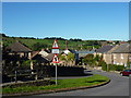
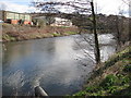
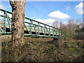

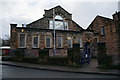
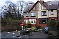
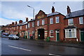
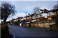
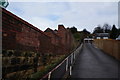
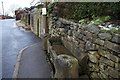
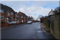
81 photos from this area
Area Information
Key information about the DE56 2UW including its size, population, and administrative classification.
- Area Type
- Postcode
- Area Size
- 21.0 hectares
- Population
- 1896
- Population Density
- 456 people/km²
House Prices in DE56 2UW
34
Properties
£279,250
Average Sold Price
£53,500
Lowest Price
£858,000
Highest Price
Showing 34 properties
| Address | Type | Beds | Baths | Last Sale Price | Last Sale Date | |
|---|---|---|---|---|---|---|
| The Setters, Chevin Road, Belper, DE56 2UW | house | - | - | £290,000 | Oct 2025 | |
| 11 Chevin Road, Belper, DE56 2UW | house | - | - | £211,000 | Jan 2025 | |
| 16 Chevin Road, Belper, DE56 2UW | Semi-detached | 3 | 1 | £239,000 | Nov 2024 | |
| 14 Chevin Road, Belper, DE56 2UW | Retail | 3 | 1 | £270,000 | Apr 2022 | |
| Robin House, 20 Chevin Road, Belper, DE56 2UW | Detached | 4 | 2 | £858,000 | Dec 2021 | |
| Sunny Mount, Chevin Road, Belper, DE56 2UW | Detached | 3 | 1 | £440,000 | Jan 2020 | |
| Frith Knoll, Chevin Road, Belper, DE56 2UW | house | - | - | £295,000 | Oct 2018 | |
| 3 Chevin Road, Belper, DE56 2UW | Semi-detached | 3 | 1 | £200,000 | Sep 2018 | |
| 2 Chevin Road, Belper, DE56 2UW | house | - | - | £140,000 | Dec 2016 | |
| Chevin Edge House, Chevin Road, Belper, DE56 2UW | Detached | - | - | £475,000 | Sep 2010 |
Page 1 of 4
Energy Efficiency in DE56 2UW
Amenities
Schools
| Rank | School | Type | Entry gender | Ages |
|---|
Explore more schools in this area
Go to Schools tabDemographics
Household Size
Two person
most common
Accommodation Type
Houses
most common
Tenure
81
majority
Ethnic Group
White
most common
Religion
N/A
most common
Household Composition
N/A
most common
Age
47
median
Adults (30-64 years)
most common
Household Deprivation
N/A
with no deprivation
NS-SEC
41
in Lower managerial occupations
Explore more demographic insights in this area
Go to Demographics tabPlanning
Planning Constraints
- Flood RiskPremium
- Ramsar Wetland SitesPremium
- Area of Outstanding Natural BeautyPremium
- Protected Nature ReservePremium
- Protected WoodlandPremium