Area Overview for DE56 2TB
Photos of DE56 2TB
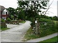
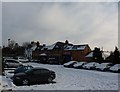
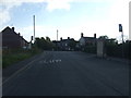
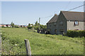
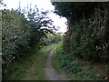
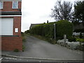
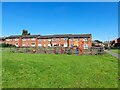
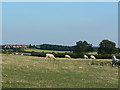
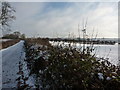

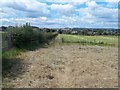
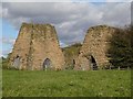
23 photos from this area
Area Information
Key information about the DE56 2TB including its size, population, and administrative classification.
- Area Type
- Postcode
- Area Size
- 3.0 hectares
- Population
- 1424
- Population Density
- 663 people/km²
House Prices in DE56 2TB
53
Properties
£145,509
Average Sold Price
£42,000
Lowest Price
£375,000
Highest Price
Showing 53 properties
| Address | Type | Beds | Baths | Last Sale Price | Last Sale Date | |
|---|---|---|---|---|---|---|
| 49 High Edge Drive, Heage, Belper, DE56 2TB | Semi-detached | 2 | 1 | £192,500 | Apr 2025 | |
| 21 High Edge Drive, Heage, Belper, DE56 2TB | Detached | 3 | 1 | £305,000 | Dec 2024 | |
| 5 High Edge Drive, Heage, Belper, DE56 2TB | Detached | 4 | 1 | £375,000 | Oct 2024 | |
| 19 High Edge Drive, Heage, Belper, DE56 2TB | Detached | 3 | 1 | £220,000 | Mar 2024 | |
| 3 High Edge Drive, Heage, Belper, DE56 2TB | Detached | 3 | 1 | £275,000 | Feb 2022 | |
| Stand View House, 41 High Edge Drive, Heage, Belper, DE56 2TB | Detached | 5 | 2 | £274,000 | Jan 2021 | |
| 43 High Edge Drive, Heage, Belper, DE56 2TB | Detached | 3 | 1 | £238,000 | Nov 2020 | |
| 17 High Edge Drive, Heage, Belper, DE56 2TB | Detached | 3 | 1 | £200,000 | Dec 2019 | |
| 39 High Edge Drive, Heage, Belper, DE56 2TB | Semi-detached | 2 | - | £156,000 | Jul 2019 | |
| 31 High Edge Drive, Heage, Belper, DE56 2TB | Bungalow | 2 | 1 | £170,000 | Jun 2019 |
Page 1 of 6
Energy Efficiency in DE56 2TB
Amenities
Schools
| Rank | School | Type | Entry gender | Ages |
|---|
Explore more schools in this area
Go to Schools tabDemographics
Household Size
Two person
most common
Accommodation Type
Houses
most common
Tenure
75
majority
Ethnic Group
White
most common
Religion
N/A
most common
Household Composition
N/A
most common
Age
47
median
Adults (30-64 years)
most common
Household Deprivation
N/A
with no deprivation
NS-SEC
29
in Lower managerial occupations
Explore more demographic insights in this area
Go to Demographics tabPlanning
Planning Constraints
- Flood RiskPremium
- Ramsar Wetland SitesPremium
- Area of Outstanding Natural BeautyPremium
- Protected Nature ReservePremium
- Protected WoodlandPremium