Area Overview for DE56 2RD
Photos of DE56 2RD
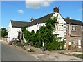
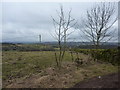
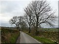
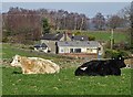
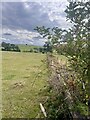
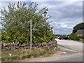
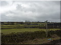
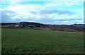
24 photos from this area
Area Information
Key information about the DE56 2RD including its size, population, and administrative classification.
- Area Type
- Postcode
- Area Size
- 1.1 km²
- Population
- 1514
- Population Density
- 34 people/km²
House Prices in DE56 2RD
24
Properties
£419,500
Average Sold Price
£30,000
Lowest Price
£850,000
Highest Price
Showing 24 properties
| Address | Type | Beds | Baths | Last Sale Price | Last Sale Date | |
|---|---|---|---|---|---|---|
| Ranch Farm, Sandhall Lane, Alderwasley, Belper, DE56 2RD | Bungalow | - | - | £850,000 | Feb 2022 | |
| Windmill Barn, Sandhall Lane, Alderwasley, Belper, DE56 2RD | Semi-detached | 4 | 2 | £685,000 | Jul 2019 | |
| Sandhall Cottage, Sandhall Lane, Alderwasley, Belper, DE56 2RD | Detached | 3 | 2 | £550,000 | May 2019 | |
| Sunrise Cottage. The Bear Hotel, Belper Road, Alderwasley, Belper, DE56 2RD | undefined | - | - | £310,000 | Jan 2000 | |
| Nyth Fa, Belper Road, Alderwasley, Belper, DE56 2RD | Detached | 3 | 3 | £92,000 | May 1999 | |
| The Bungalow Packhorse Farm, Belper Road, Alderwasley, Belper, DE56 2RD | Farm | 5 | 3 | £30,000 | Apr 1995 | |
| Beech Farm, Sandhall Lane, Alderwasley, Belper, DE56 2RD | Detached | 3 | 2 | - | - | |
| Ta Clear Springs Farm, Clear Springs Farm, Sandhall Lane, Alderwasley, Belper, DE56 2RD | house | - | - | - | - | |
| Wind Tturbine, Sandhall Farm, Sandhall Lane, Alderwasley, Belper, DE56 2RD | Industrial | - | - | - | - | |
| Ta Dairy Farm, Dairy Farm, Nether Common Farm, Sandyford Lane, Alderwasley, Belper, DE56 2RD | shop | - | - | - | - |
Page 1 of 3
Energy Efficiency in DE56 2RD
Amenities
Schools
| Rank | School | Type | Entry gender | Ages |
|---|
Explore more schools in this area
Go to Schools tabDemographics
Household Size
Two person
most common
Accommodation Type
Houses
most common
Tenure
86
majority
Ethnic Group
White
most common
Religion
N/A
most common
Household Composition
N/A
most common
Age
47
median
Adults (30-64 years)
most common
Household Deprivation
N/A
with no deprivation
NS-SEC
43
in Lower managerial occupations
Explore more demographic insights in this area
Go to Demographics tabPlanning
Planning Constraints
- Flood RiskPremium
- Ramsar Wetland SitesPremium
- Area of Outstanding Natural BeautyPremium
- Protected Nature ReservePremium
- Protected WoodlandPremium