Area Overview for DE56 2FZ
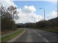
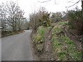
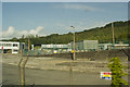
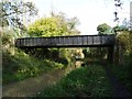
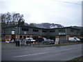
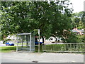
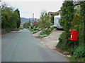
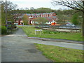
Photos of DE56 2FZ
Area Information
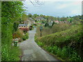
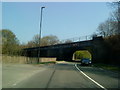
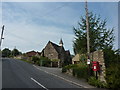
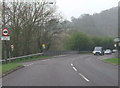
Living in DE56 2FZ means being part of a small, tightly knit residential cluster in England. The area covers just 1.6 hectares, housing 1,876 people across a population density of 588 per square kilometre. This compact postcode is characterised by its focus on homeownership, with 88% of properties occupied by owners. The community is predominantly middle-aged, with a median age of 47 and most residents falling within the 30–64 age range. Daily life here is shaped by proximity to local amenities, including five nearby rail stations such as Ambergate and Belper, and accessible retail hubs like Morrisons Daily and Tesco Alton. While the area lacks large-scale infrastructure, its small size fosters a sense of familiarity. Families benefit from Ambergate Primary School, rated ‘good’ by Ofsted, and the surrounding countryside offers quiet, low-traffic living. However, residents should be aware of the area’s high flood risk, a critical factor in planning long-term stays. For those seeking a manageable, community-focused environment with practical transport links, DE56 2FZ provides a blend of simplicity and accessibility.
- Area Type
- Postcode
- Area Size
- 1.6 hectares
- Population
- 1876
- Population Density
- 588 people/km²
The property market in DE56 2FZ is dominated by owner-occupied homes, with 88% of properties owned by residents rather than rented. The accommodation type is exclusively houses, which is unusual for a small postcode area but suggests a focus on single-family dwellings. This composition indicates a market where buyers are likely to be purchasing for long-term residence rather than investment. The lack of flats or rental properties means the area is not a hotspot for landlords or young professionals seeking affordable housing. For buyers considering DE56 2FZ, the limited size of the area and the prevalence of houses may mean fewer options but potentially more established properties. The compact nature of the postcode also means that properties are likely to be in close proximity to local amenities, such as rail stations and schools. However, the high flood risk assessment could affect property values or insurance costs, a factor worth considering for prospective buyers.
House Prices in DE56 2FZ
Showing 1 properties
| Address | Type | Beds | Baths | Last Sale Price | Last Sale Date | |
|---|---|---|---|---|---|---|
| National Grid, Pipelines Maintenance Centre, Ripley Road, Ambergate, Belper, DE56 2FZ | office_workshop | - | - | - | - |
Energy Efficiency in DE56 2FZ
The lifestyle in DE56 2FZ is shaped by its proximity to practical amenities, including five rail stations and five retail outlets such as Morrisons Daily, Budgens Crich, and Tesco Alton. These shops provide access to groceries, fuel, and everyday essentials without requiring long journeys. The area’s small size means that amenities are within walking or short driving distance, fostering convenience. Residents can also reach metro stops at Wirksworth and Idridgehay, offering additional transport options. While there is no mention of parks or leisure facilities in the data, the nearby rail stations and retail hubs suggest a focus on functional living rather than expansive recreational spaces. The presence of multiple retail outlets and transport links implies a community that values accessibility over luxury. For those prioritising ease of access to shops and transport, DE56 2FZ offers a straightforward, no-frills lifestyle with minimal need for long commutes or travel.
Amenities
Schools
The nearest school to DE56 2FZ is Ambergate Primary School, a primary school rated ‘good’ by Ofsted. This single school serves the area’s primary education needs, offering a straightforward option for families with young children. The absence of secondary schools or other educational institutions within the postcode means parents may need to look beyond the immediate vicinity for further schooling. However, the proximity of Ambergate Primary School to local homes reduces commuting times and supports a family-friendly environment. The school’s ‘good’ rating suggests a satisfactory standard of education, though the lack of additional schools limits options for older children. For families prioritising ease of access to schools, DE56 2FZ’s primary school is a practical asset, but the area’s small size means it is not a hub for broader educational infrastructure.
| Rank | School | Type | Entry gender | Ages |
|---|
Explore more schools in this area
Go to Schools tabDemographics
DE56 2FZ is a community defined by its adult demographic, with 88% of residents owning their homes and the majority aged between 30 and 64. The median age of 47 suggests a stable, established population, with fewer younger families or elderly residents. The predominant ethnic group is White, reflecting the area’s homogeneity. This demographic profile influences the character of daily life: homeownership is high, indicating long-term residency and investment in property. The absence of specific data on deprivation or diversity means the area’s social dynamics are largely shaped by its age and ownership profiles. With no mention of rental properties or multi-generational households, the community appears to prioritise stability over transient living. For buyers, this suggests a market where properties are likely to be family homes rather than short-term investments. The focus on homeownership also aligns with the area’s compact size, where residents may prefer the security of owning a house in a low-density, familiar environment.
Household Size
Accommodation Type
Tenure
Ethnic Group
Religion
Household Composition
Age
Household Deprivation
NS-SEC
Explore more demographic insights in this area
Go to Demographics tabPlanning
Planning Constraints
- Flood RiskPremium
- Ramsar Wetland SitesPremium
- Area of Outstanding Natural BeautyPremium
- Protected Nature ReservePremium
- Protected WoodlandPremium