Area Overview for DE56 2FT
Photos of DE56 2FT
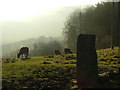

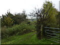
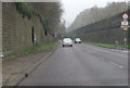


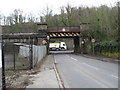


69 photos from this area
Area Information
Key information about the DE56 2FT including its size, population, and administrative classification.
- Area Type
- Postcode
- Area Size
- 2.2 hectares
- Population
- 2314
- Population Density
- 115 people/km²
House Prices in DE56 2FT
12
Properties
£327,600
Average Sold Price
£195,000
Lowest Price
£506,000
Highest Price
Showing 12 properties
| Address | Type | Beds | Baths | Last Sale Price | Last Sale Date | |
|---|---|---|---|---|---|---|
| 3, Valley View, Front Street, Fritchley, Belper, DE56 2FT | Terraced | 3 | 2 | £506,000 | May 2022 | |
| Braystones, Front Street, Fritchley, Belper, DE56 2FT | Detached | 4 | 2 | £460,000 | Feb 2017 | |
| Red Lion Cottage, Front Street, Fritchley, Belper, DE56 2FT | Detached | 3 | 2 | £195,000 | Dec 2009 | |
| Park View, Front Street, Fritchley, Belper, DE56 2FT | Semi-detached | - | - | £282,000 | Aug 2006 | |
| The Cottage, Front Street, Fritchley, Belper, DE56 2FT | Detached | 3 | 2 | £195,000 | Jul 2004 | |
| The Hideaway, Front Street, Fritchley, Belper, DE56 2FT | Bungalow | 3 | - | - | - | |
| Cherry Tree Cottage, 3 Front Street, Fritchley, Belper, DE56 2FT | Terraced | 2 | 3 | - | - | |
| 1, Valley View, Front Street, Fritchley, Belper, DE56 2FT | Terraced | 4 | - | - | - | |
| Plumtree Cottage, Front Street, Fritchley, Belper, DE56 2FT | house | - | - | - | - | |
| Red Lion, Front Street, Fritchley, Belper, DE56 2FT | restaurant_cafe | - | - | - | - |
Page 1 of 2
Energy Efficiency in DE56 2FT
Amenities
Schools
| Rank | School | Type | Entry gender | Ages |
|---|
Explore more schools in this area
Go to Schools tabDemographics
Household Size
Two person
most common
Accommodation Type
Houses
most common
Tenure
81
majority
Ethnic Group
White
most common
Religion
N/A
most common
Household Composition
N/A
most common
Age
47
median
Adults (30-64 years)
most common
Household Deprivation
N/A
with no deprivation
NS-SEC
38
in Lower managerial occupations
Explore more demographic insights in this area
Go to Demographics tabPlanning
Planning Constraints
- Flood RiskPremium
- Ramsar Wetland SitesPremium
- Area of Outstanding Natural BeautyPremium
- Protected Nature ReservePremium
- Protected WoodlandPremium