Area Overview for DE56 1TF
Photos of DE56 1TF
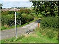

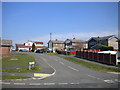
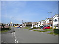
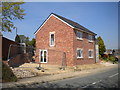
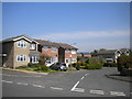

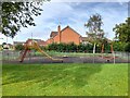
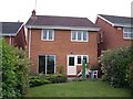
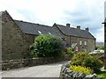
17 photos from this area
Area Information
Key information about the DE56 1TF including its size, population, and administrative classification.
- Area Type
- Postcode
- Area Size
- 3285 m²
- Population
- 1305
- Population Density
- 6457 people/km²
House Prices in DE56 1TF
14
Properties
£122,318
Average Sold Price
£48,000
Lowest Price
£235,000
Highest Price
Showing 14 properties
| Address | Type | Beds | Baths | Last Sale Price | Last Sale Date | |
|---|---|---|---|---|---|---|
| 62 Edensor Drive, Far Laund, Belper, DE56 1TF | Terraced | 2 | 1 | £152,500 | Aug 2024 | |
| 82 Edensor Drive, Far Laund, Belper, DE56 1TF | Semi-detached | 3 | 1 | £235,000 | Sep 2021 | |
| 70 Edensor Drive, Far Laund, Belper, DE56 1TF | Terraced | 2 | 1 | £150,000 | Dec 2020 | |
| 72 Edensor Drive, Far Laund, Belper, DE56 1TF | Terraced | 2 | - | £147,000 | Nov 2019 | |
| 76 Edensor Drive, Far Laund, Belper, DE56 1TF | Semi-detached | 2 | 1 | £125,000 | Aug 2014 | |
| 64 Edensor Drive, Far Laund, Belper, DE56 1TF | house | 2 | - | £118,500 | Jan 2014 | |
| 80 Edensor Drive, Far Laund, Belper, DE56 1TF | Semi-detached | 3 | 1 | £152,500 | Jul 2013 | |
| 66 Edensor Drive, Far Laund, Belper, DE56 1TF | house | 3 | 1 | £146,000 | May 2007 | |
| 60 Edensor Drive, Far Laund, Belper, DE56 1TF | house | 3 | - | £141,000 | May 2006 | |
| 74 Edensor Drive, Far Laund, Belper, DE56 1TF | Terraced | - | - | £138,000 | Oct 2004 |
Page 1 of 2
Energy Efficiency in DE56 1TF
Amenities
Schools
| Rank | School | Type | Entry gender | Ages |
|---|
Explore more schools in this area
Go to Schools tabDemographics
Household Size
Family (3-5 people)
most common
Accommodation Type
Houses
most common
Tenure
80
majority
Ethnic Group
White
most common
Religion
N/A
most common
Household Composition
N/A
most common
Age
47
median
Adults (30-64 years)
most common
Household Deprivation
N/A
with no deprivation
NS-SEC
40
in Lower managerial occupations
Explore more demographic insights in this area
Go to Demographics tabPlanning
Planning Constraints
- Flood RiskPremium
- Ramsar Wetland SitesPremium
- Area of Outstanding Natural BeautyPremium
- Protected Nature ReservePremium
- Protected WoodlandPremium