Area Overview for DE56 1SD
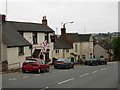
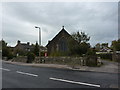
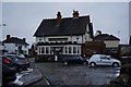
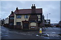
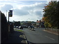
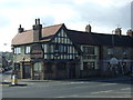
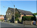
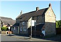
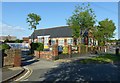
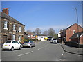
Photos of DE56 1SD


Area Information
Living in DE56 1SD means being part of a tightly knit residential cluster in England, where 1,380 residents occupy a compact 4,719 square metres. The area’s high population density—292,414 people per square kilometre—reflects a community centred around homes rather than larger developments. With a median age of 47 and a majority of residents aged 30–64, this is a mature, stable area where families and long-term residents predominate. The focus on house ownership—73% of homes are owner-occupied—suggests a settled population. Daily life here is shaped by proximity to essential services: nearby rail stations, retail outlets, and the primary school at Belper School and Sixth Form Centre. The area’s small size means amenities are within practical reach, while the low crime risk and excellent broadband connectivity support both work and leisure. DE56 1SD is a place where practicality meets convenience, ideal for those seeking a quiet, connected residential environment without the sprawl of larger towns.
- Area Type
- Postcode
- Area Size
- 4719 m²
- Population
- 1380
- Population Density
- 3159 people/km²
DE56 1SD’s property market is dominated by owner-occupied homes, with 73% of residences being owned rather than rented. The accommodation type is primarily houses, which is uncommon in many urban areas but typical of smaller, rural or semi-rural postcode clusters. This suggests a market skewed towards private buyers seeking family homes or long-term investments, rather than landlords targeting rental income. The area’s small size—just 4,719 square metres—means the housing stock is limited, likely comprising a mix of older and newer properties. For buyers, this presents both opportunities and constraints: the scarcity of properties may drive competition, but the focus on owner-occupation could indicate strong demand from local residents. Proximity to rail stations and schools adds to the area’s appeal, though the lack of larger developments means buyers must consider the immediate surroundings for additional options.
House Prices in DE56 1SD
Showing 8 properties
| Address | Type | Beds | Baths | Last Sale Price | Last Sale Date | |
|---|---|---|---|---|---|---|
| 1 Kilbourne Court Close, Belper, DE56 1SD | Detached | 4 | 1 | £375,995 | Jun 2018 | |
| 6 Kilbourne Court Close, Belper, DE56 1SD | Detached | 4 | 2 | - | - | |
| 2 Kilbourne Court Close, Belper, DE56 1SD | Detached | 4 | 2 | - | - | |
| 5 Kilbourne Court Close, Belper, DE56 1SD | Detached | 4 | - | - | - | |
| 3 Kilbourne Court Close, Belper, DE56 1SD | Detached | 4 | - | - | - | |
| 8 Kilbourne Court Close, Belper, DE56 1SD | house | - | - | - | - | |
| 4 Kilbourne Court Close, Belper, DE56 1SD | house | - | - | - | - | |
| 7 Kilbourne Court Close, Belper, DE56 1SD | house | - | - | - | - |
Energy Efficiency in DE56 1SD
Residents of DE56 1SD have access to a range of nearby amenities, including five retail outlets such as Co-op Openwood, Co-op Whitemoor, and Tesco Alton, which provide essential shopping and services. The rail network, with stations at Belper, Duffield, and Ambergate, offers convenient travel options, while the Idridgehay metro station adds another layer of connectivity. Though the area is small, the proximity to these amenities ensures daily needs are met without long commutes. The character of the area is shaped by its compact size and practical layout, where local shops and transport hubs create a self-contained environment. For those valuing convenience, the mix of retail and transport options supports a lifestyle that balances independence with accessibility.
Amenities
Schools
The nearest school to DE56 1SD is Belper School and Sixth Form Centre, a primary school with an Ofsted rating of satisfactory. This provides families with a local option for younger children, though the absence of secondary schools or other educational institutions in the data means parents may need to look beyond the immediate area for comprehensive schooling. The presence of a primary school suggests the area is suitable for families with young children, though the rating indicates there is room for improvement in educational standards. For those prioritising school quality, proximity to this institution may be a key consideration, but additional research into secondary education options would be necessary for long-term family planning.
| Rank | School | Type | Entry gender | Ages |
|---|
Explore more schools in this area
Go to Schools tabDemographics
DE56 1SD’s population of 1,380 is predominantly composed of adults aged 30–64, with a median age of 47. This suggests a community of middle-aged residents, many of whom may be in their peak earning years or nearing retirement. The high home ownership rate—73%—indicates a stable, long-term demographic, with most properties being houses rather than flats or apartments. The predominant ethnic group is White, reflecting the area’s homogeneous character. While no specific data on deprivation is provided, the high home ownership and mature age profile suggest a relatively affluent or stable population. The absence of significant demographic diversity may appeal to those seeking a familiar, low-contrast community. However, this also means the area’s social dynamics are likely shaped by shared cultural and economic backgrounds, which could influence local services and amenities.
Household Size
Accommodation Type
Tenure
Ethnic Group
Religion
Household Composition
Age
Household Deprivation
NS-SEC
Explore more demographic insights in this area
Go to Demographics tabPlanning
Planning Constraints
- Flood RiskPremium
- Ramsar Wetland SitesPremium
- Area of Outstanding Natural BeautyPremium
- Protected Nature ReservePremium
- Protected WoodlandPremium