Area Overview for DE56 1PY
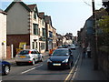
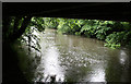
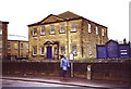
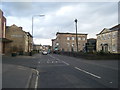
Photos of DE56 1PY


Area Information
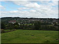
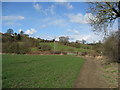
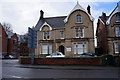
Living in DE56 1PY offers a quiet, residential experience in a small cluster of homes with a population of 1,981. The area is characterised by its modest size and proximity to nearby towns, making it a practical choice for those seeking a balance between seclusion and accessibility. With a median age of 47, the community is predominantly composed of adults aged 30–64, suggesting a stable, established demographic. The area’s housing stock is largely made up of individual homes, reflecting a traditional, family-oriented environment. Residents benefit from nearby retail options, including Co-op, Iceland, and Aldi in Belper, as well as rail links to Belper, Duffield, and Ambergate. While the postcode is small, it connects to broader networks via metro stations in Idridgehay and Wirksworth. The area’s low flood risk and absence of environmental constraints make it a straightforward place to live, though its medium crime risk means standard security measures are advisable.
- Area Type
- Postcode
- Area Size
- Not available
- Population
- 1981
- Population Density
- 2857 people/km²
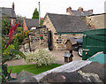
DE56 1PY is a small area with a housing stock dominated by individual homes, reflecting a preference for family-oriented living. With 58% of properties owner-occupied, the market is not heavily influenced by rental demand, though the exact proportion of rental properties is unspecified. The predominance of houses suggests a focus on larger, more permanent residences, which may appeal to buyers seeking space and stability. Given the area’s limited size, property availability is constrained, and buyers should consider proximity to nearby towns for broader options. The lack of high-density housing or apartments means the market caters to those prioritising private, standalone homes over urban or shared living arrangements.
House Prices in DE56 1PY
No properties found in this postcode.
Energy Efficiency in DE56 1PY
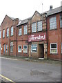
Daily life in DE56 1PY is shaped by its proximity to Belper’s retail options, including Co-op, Iceland, and Aldi, which provide essential shopping needs. The area’s rail links to Belper, Duffield, and Ambergate, along with metro stations in Idridgehay and Wirksworth, offer flexibility for commuting or leisure travel. While the postcode itself lacks large parks or leisure facilities, its connection to nearby towns ensures access to broader amenities. The modest scale of the area fosters a close-knit community, with residents relying on local shops and transport networks for convenience. The absence of major attractions within the postcode means lifestyle choices are influenced by proximity to larger towns, but the existing infrastructure supports a practical, low-maintenance way of living.
Amenities
Schools
The nearest school to DE56 1PY is Rowen House School, an independent institution. No Ofsted rating is provided, but its status as an independent school may indicate a focus on specialist or selective education. The absence of state schools in the immediate area means families may need to look further afield for public education options. For those prioritising independent schooling, Rowen House offers a dedicated option, though parents should consider travel time and additional costs. The limited school choice in the area underscores the need for careful planning when evaluating the suitability of DE56 1PY for families.
| Rank | School | Type | Entry gender | Ages |
|---|
Explore more schools in this area
Go to Schools tabDemographics
The population of DE56 1PY is 1,981, with a median age of 47. The majority of residents fall within the 30–64 age range, indicating a mature, stable community. Home ownership is at 58%, suggesting a mix of owner-occupied properties and rental units. The accommodation type is predominantly houses, which aligns with the area’s traditional residential character. The predominant ethnic group is White, reflecting a homogenous demographic profile. While no specific data on deprivation is provided, the age distribution and home ownership rate suggest a community focused on long-term residency and family living. The absence of detailed diversity statistics means the area’s social composition remains largely unexplored in public records.
Household Size
Accommodation Type
Tenure
Ethnic Group
Religion
Household Composition
Age
Household Deprivation
NS-SEC
Explore more demographic insights in this area
Go to Demographics tabPlanning
Planning Constraints
- Flood RiskPremium
- Ramsar Wetland SitesPremium
- Area of Outstanding Natural BeautyPremium
- Protected Nature ReservePremium
- Protected WoodlandPremium