Area Overview for DE56 1LD
Photos of DE56 1LD
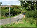

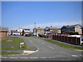
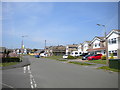
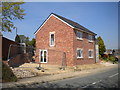
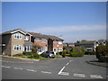
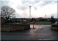
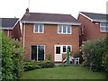

17 photos from this area
Area Information
Key information about the DE56 1LD including its size, population, and administrative classification.
- Area Type
- Postcode
- Area Size
- 1.4 hectares
- Population
- 1682
- Population Density
- 4866 people/km²
House Prices in DE56 1LD
19
Properties
£178,383
Average Sold Price
£50,000
Lowest Price
£345,000
Highest Price
Showing 19 properties
| Address | Type | Beds | Baths | Last Sale Price | Last Sale Date | |
|---|---|---|---|---|---|---|
| 13 Westbury Gardens, Whitemoor, Belper, DE56 1LD | Retail | 4 | 1 | £345,000 | Sep 2022 | |
| 9 Westbury Gardens, Whitemoor, Belper, DE56 1LD | Detached | 3 | 2 | £255,000 | Feb 2020 | |
| 11 Westbury Gardens, Whitemoor, Belper, DE56 1LD | Detached | 4 | - | £229,000 | Aug 2016 | |
| 1 Westbury Gardens, Whitemoor, Belper, DE56 1LD | Detached | 3 | - | £202,500 | May 2016 | |
| 18 Westbury Gardens, Whitemoor, Belper, DE56 1LD | house | - | - | £222,000 | Nov 2014 | |
| 8 Westbury Gardens, Whitemoor, Belper, DE56 1LD | Bungalow | 2 | 1 | £167,000 | Jul 2013 | |
| 10 Westbury Gardens, Whitemoor, Belper, DE56 1LD | Detached | - | - | £77,950 | Jul 2000 | |
| 4 Westbury Gardens, Whitemoor, Belper, DE56 1LD | Detached | 3 | 1 | £50,000 | Apr 1998 | |
| 20 Westbury Gardens, Whitemoor, Belper, DE56 1LD | Detached | - | - | £57,000 | Dec 1995 | |
| 16 Westbury Gardens, Whitemoor, Belper, DE56 1LD | Detached | - | - | - | - |
Page 1 of 2
Energy Efficiency in DE56 1LD
Amenities
Schools
| Rank | School | Type | Entry gender | Ages |
|---|
Explore more schools in this area
Go to Schools tabDemographics
Household Size
Two person
most common
Accommodation Type
Houses
most common
Tenure
85
majority
Ethnic Group
White
most common
Religion
N/A
most common
Household Composition
N/A
most common
Age
47
median
Adults (30-64 years)
most common
Household Deprivation
N/A
with no deprivation
NS-SEC
34
in Lower managerial occupations
Explore more demographic insights in this area
Go to Demographics tabPlanning
Planning Constraints
- Flood RiskPremium
- Ramsar Wetland SitesPremium
- Area of Outstanding Natural BeautyPremium
- Protected Nature ReservePremium
- Protected WoodlandPremium