Area Overview for DE56 1HA
Photos of DE56 1HA
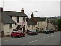
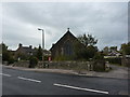
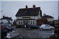
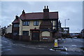
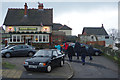
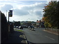
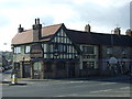
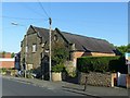
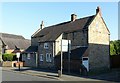
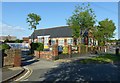
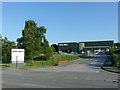
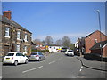
29 photos from this area
Area Information
Key information about the DE56 1HA including its size, population, and administrative classification.
- Area Type
- Postcode
- Area Size
- 1.8 hectares
- Population
- 1682
- Population Density
- 4866 people/km²
House Prices in DE56 1HA
53
Properties
£135,761
Average Sold Price
£10,000
Lowest Price
£330,000
Highest Price
Showing 53 properties
| Address | Type | Beds | Baths | Last Sale Price | Last Sale Date | |
|---|---|---|---|---|---|---|
| 53 Kilbourne Road, Belper, DE56 1HA | Terraced | 2 | 1 | £197,500 | Aug 2025 | |
| 39 Kilbourne Road, Belper, DE56 1HA | Terraced | 2 | 1 | £190,000 | Jul 2025 | |
| 15 Kilbourne Road, Belper, DE56 1HA | Terraced | 2 | 1 | £152,500 | Jun 2025 | |
| 19 Kilbourne Road, Belper, DE56 1HA | Terraced | 2 | 1 | £157,000 | May 2025 | |
| 31 Kilbourne Road, Belper, DE56 1HA | Cottage | 2 | 1 | £159,000 | Mar 2025 | |
| 55 Kilbourne Road, Belper, DE56 1HA | Terraced | 3 | 1 | £100,000 | May 2024 | |
| 17 Kilbourne Road, Belper, DE56 1HA | Terraced | 2 | 1 | £135,000 | Nov 2023 | |
| 12 Kilbourne Road, Belper, DE56 1HA | Terraced | 3 | 1 | £155,000 | Oct 2023 | |
| 8 Kilbourne Road, Belper, DE56 1HA | Retail | 3 | 1 | £271,000 | Oct 2022 | |
| 1 Kilbourne Road, Belper, DE56 1HA | Semi-detached | 3 | 1 | £232,000 | Aug 2022 |
Page 1 of 6
Energy Efficiency in DE56 1HA
Amenities
Schools
| Rank | School | Type | Entry gender | Ages |
|---|
Explore more schools in this area
Go to Schools tabDemographics
Household Size
Two person
most common
Accommodation Type
Houses
most common
Tenure
85
majority
Ethnic Group
White
most common
Religion
N/A
most common
Household Composition
N/A
most common
Age
47
median
Adults (30-64 years)
most common
Household Deprivation
N/A
with no deprivation
NS-SEC
34
in Lower managerial occupations
Explore more demographic insights in this area
Go to Demographics tabPlanning
Planning Constraints
- Flood RiskPremium
- Ramsar Wetland SitesPremium
- Area of Outstanding Natural BeautyPremium
- Protected Nature ReservePremium
- Protected WoodlandPremium