Area Overview for DE56 1FD
Photos of DE56 1FD
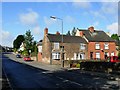
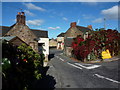


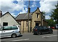


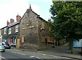

98 photos from this area
Area Information
Key information about the DE56 1FD including its size, population, and administrative classification.
- Area Type
- Postcode
- Area Size
- 1.9 hectares
- Population
- 1644
- Population Density
- 1570 people/km²
House Prices in DE56 1FD
29
Properties
£168,235
Average Sold Price
£33,000
Lowest Price
£487,000
Highest Price
Showing 29 properties
| Address | Type | Beds | Baths | Last Sale Price | Last Sale Date | |
|---|---|---|---|---|---|---|
| 4 Chesterfield Road, Belper, DE56 1FD | Retail | 2 | 1 | £161,000 | Oct 2022 | |
| 10 Chesterfield Road, Belper, DE56 1FD | Semi-detached | 3 | - | £325,000 | May 2021 | |
| 15 Chesterfield Road, Belper, DE56 1FD | Detached | 4 | 2 | £350,000 | Mar 2021 | |
| 12A Chesterfield Road, Belper, DE56 1FD | Detached | 3 | 1 | £220,000 | Dec 2018 | |
| 9 Chesterfield Road, Belper, DE56 1FD | Detached | 4 | 2 | £487,000 | Jul 2018 | |
| West View Cottage, 30 Chesterfield Road, Belper, DE56 1FD | Semi-detached | 2 | 1 | £129,000 | Nov 2017 | |
| 14 Chesterfield Road, Belper, DE56 1FD | Semi-detached | 3 | 2 | £150,000 | Jun 2017 | |
| 26A Chesterfield Road, Belper, DE56 1FD | Flat | - | - | £107,000 | Sep 2015 | |
| 16 Chesterfield Road, Belper, DE56 1FD | Cottage | 3 | 1 | £194,000 | Jun 2015 | |
| 11A Chesterfield Road, Belper, DE56 1FD | Cottage | 3 | 2 | £196,000 | Dec 2013 |
Page 1 of 3
Energy Efficiency in DE56 1FD
Amenities
Schools
| Rank | School | Type | Entry gender | Ages |
|---|
Explore more schools in this area
Go to Schools tabDemographics
Household Size
One person
most common
Accommodation Type
Houses
most common
Tenure
73
majority
Ethnic Group
White
most common
Religion
N/A
most common
Household Composition
N/A
most common
Age
47
median
Adults (30-64 years)
most common
Household Deprivation
N/A
with no deprivation
NS-SEC
40
in Lower managerial occupations
Explore more demographic insights in this area
Go to Demographics tabPlanning
Planning Constraints
- Flood RiskPremium
- Ramsar Wetland SitesPremium
- Area of Outstanding Natural BeautyPremium
- Protected Nature ReservePremium
- Protected WoodlandPremium