Area Overview for DE56 1ET
Photos of DE56 1ET

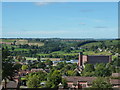
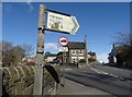
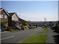
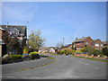
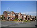
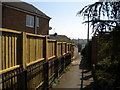


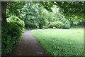
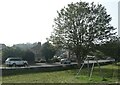
22 photos from this area
Area Information
Key information about the DE56 1ET including its size, population, and administrative classification.
- Area Type
- Postcode
- Area Size
- 2.7 hectares
- Population
- 1388
- Population Density
- 1121 people/km²
House Prices in DE56 1ET
52
Properties
£187,828
Average Sold Price
£43,000
Lowest Price
£325,000
Highest Price
Showing 52 properties
| Address | Type | Beds | Baths | Last Sale Price | Last Sale Date | |
|---|---|---|---|---|---|---|
| 30 Laund Close, Belper, DE56 1ET | house | 3 | 1 | £285,000 | Oct 2024 | |
| 36 Laund Close, Belper, DE56 1ET | Detached | 3 | 1 | £208,000 | Jul 2024 | |
| 29 Laund Close, Belper, DE56 1ET | house | - | - | £325,000 | Nov 2022 | |
| 50 Laund Close, Belper, DE56 1ET | house | - | - | £269,950 | Sep 2021 | |
| 4 Laund Close, Belper, DE56 1ET | Detached | 4 | 1 | £310,000 | Jul 2021 | |
| 16 Laund Close, Belper, DE56 1ET | Bungalow | - | - | £240,000 | Jun 2021 | |
| 52 Laund Close, Belper, DE56 1ET | Detached | 3 | 1 | £218,500 | Feb 2021 | |
| 20 Laund Close, Belper, DE56 1ET | Detached | 3 | 1 | £279,950 | Jan 2021 | |
| 15 Laund Close, Belper, DE56 1ET | house | - | - | £242,500 | Dec 2020 | |
| 38 Laund Close, Belper, DE56 1ET | Bungalow | - | - | £186,000 | Oct 2019 |
Page 1 of 6
Energy Efficiency in DE56 1ET
Amenities
Schools
| Rank | School | Type | Entry gender | Ages |
|---|
Explore more schools in this area
Go to Schools tabDemographics
Household Size
Two person
most common
Accommodation Type
Houses
most common
Tenure
86
majority
Ethnic Group
White
most common
Religion
N/A
most common
Household Composition
N/A
most common
Age
47
median
Adults (30-64 years)
most common
Household Deprivation
N/A
with no deprivation
NS-SEC
35
in Lower managerial occupations
Explore more demographic insights in this area
Go to Demographics tabPlanning
Planning Constraints
- Flood RiskPremium
- Ramsar Wetland SitesPremium
- Area of Outstanding Natural BeautyPremium
- Protected Nature ReservePremium
- Protected WoodlandPremium