Area Overview for DE56 1EJ
Photos of DE56 1EJ

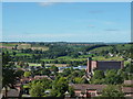
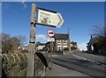
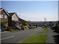
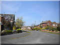
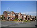
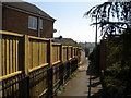
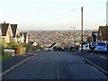
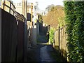
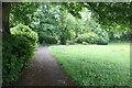
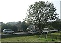
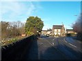
22 photos from this area
Area Information
Key information about the DE56 1EJ including its size, population, and administrative classification.
- Area Type
- Postcode
- Area Size
- 6.0 hectares
- Population
- 1388
- Population Density
- 1121 people/km²
House Prices in DE56 1EJ
38
Properties
£177,192
Average Sold Price
£36,000
Lowest Price
£550,000
Highest Price
Showing 38 properties
| Address | Type | Beds | Baths | Last Sale Price | Last Sale Date | |
|---|---|---|---|---|---|---|
| 51 Cemetery Road, Belper, DE56 1EJ | Terraced | 2 | 1 | £210,000 | May 2024 | |
| 18 Cemetery Road, Belper, DE56 1EJ | Semi-detached | 3 | 1 | £278,950 | Sep 2023 | |
| 24 Cemetery Road, Belper, DE56 1EJ | Semi-detached | 4 | 3 | £260,000 | Dec 2021 | |
| 59 Cemetery Road, Belper, DE56 1EJ | Detached | 4 | 3 | £550,000 | Sep 2021 | |
| 47 Cemetery Road, Belper, DE56 1EJ | Semi-detached | 2 | 1 | £189,950 | Mar 2021 | |
| 27 Cemetery Road, Belper, DE56 1EJ | Terraced | 2 | 1 | £170,500 | Jun 2020 | |
| Mill View Cottage, 31 Cemetery Road, Belper, DE56 1EJ | Terraced | 2 | 1 | £193,000 | Dec 2018 | |
| 14 Cemetery Road, Belper, DE56 1EJ | Semi-detached | 4 | - | £210,000 | Jul 2017 | |
| Rowan Tree Cottage, 37 Cemetery Road, Belper, DE56 1EJ | house | 2 | 2 | £167,500 | May 2016 | |
| The Old Coach House, 19 Cemetery Road, Belper, DE56 1EJ | Terraced | 2 | 1 | £98,000 | Oct 2015 |
Page 1 of 4
Energy Efficiency in DE56 1EJ
Amenities
Schools
| Rank | School | Type | Entry gender | Ages |
|---|
Explore more schools in this area
Go to Schools tabDemographics
Household Size
Two person
most common
Accommodation Type
Houses
most common
Tenure
86
majority
Ethnic Group
White
most common
Religion
N/A
most common
Household Composition
N/A
most common
Age
47
median
Adults (30-64 years)
most common
Household Deprivation
N/A
with no deprivation
NS-SEC
35
in Lower managerial occupations
Explore more demographic insights in this area
Go to Demographics tabPlanning
Planning Constraints
- Flood RiskPremium
- Ramsar Wetland SitesPremium
- Area of Outstanding Natural BeautyPremium
- Protected Nature ReservePremium
- Protected WoodlandPremium