Area Overview for DE56 1DL
Photos of DE56 1DL
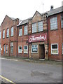
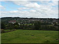
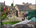

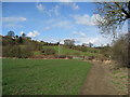
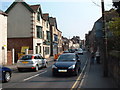
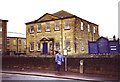
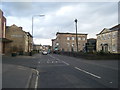
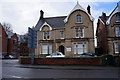
100 photos from this area
Area Information
Key information about the DE56 1DL including its size, population, and administrative classification.
- Area Type
- Postcode
- Area Size
- 9703 m²
- Population
- 1644
- Population Density
- 1570 people/km²
House Prices in DE56 1DL
38
Properties
£187,816
Average Sold Price
£49,500
Lowest Price
£343,000
Highest Price
Showing 38 properties
| Address | Type | Beds | Baths | Last Sale Price | Last Sale Date | |
|---|---|---|---|---|---|---|
| 26 George Street, Belper, DE56 1DL | Character Property | 3 | 2 | £305,000 | Jun 2025 | |
| 21 George Street, Belper, DE56 1DL | Terraced | 2 | 1 | £265,265 | Oct 2023 | |
| 3 George Street, Belper, DE56 1DL | Terraced | 3 | 2 | £302,000 | May 2022 | |
| 19 George Street, Belper, DE56 1DL | Retail | 2 | 1 | £314,999 | May 2022 | |
| 38 George Street, Belper, DE56 1DL | Retail | 3 | 1 | £343,000 | May 2022 | |
| 17 George Street, Belper, DE56 1DL | Detached | 2 | 1 | £210,000 | Sep 2021 | |
| 18 George Street, Belper, DE56 1DL | Terraced | 2 | 1 | £288,000 | Feb 2021 | |
| 11 George Street, Belper, DE56 1DL | Cottage | 3 | 2 | £304,300 | Dec 2020 | |
| 37 George Street, Belper, DE56 1DL | house | 3 | 1 | £270,000 | Mar 2020 | |
| 28 George Street, Belper, DE56 1DL | Terraced | 4 | 2 | £265,000 | Nov 2017 |
Page 1 of 4
Energy Efficiency in DE56 1DL
Amenities
Schools
| Rank | School | Type | Entry gender | Ages |
|---|
Explore more schools in this area
Go to Schools tabDemographics
Household Size
One person
most common
Accommodation Type
Houses
most common
Tenure
73
majority
Ethnic Group
White
most common
Religion
N/A
most common
Household Composition
N/A
most common
Age
47
median
Adults (30-64 years)
most common
Household Deprivation
N/A
with no deprivation
NS-SEC
40
in Lower managerial occupations
Explore more demographic insights in this area
Go to Demographics tabPlanning
Planning Constraints
- Flood RiskPremium
- Ramsar Wetland SitesPremium
- Area of Outstanding Natural BeautyPremium
- Protected Nature ReservePremium
- Protected WoodlandPremium