Area Overview for DE56 1AJ
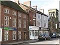
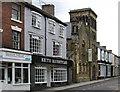
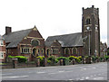
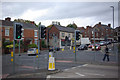
Photos of DE56 1AJ


Area Information
Living in DE56 1AJ means being part of a tightly knit residential cluster in England, home to 1,712 people spread across a compact area with a density of 860 people per square kilometre. This postcode is not a sprawling suburb but a defined community where daily life is shaped by proximity to local amenities and transport links. The area’s small size means it is likely to feel cohesive, with residents sharing access to nearby shops, schools, and rail services. It is a place where the pace of life is moderate, with a median age of 47 suggesting a stable population of adults aged 30–64. While the data does not specify the presence of parks or green spaces, the absence of environmental constraints like AONB or protected woodlands implies a focus on residential living rather than conservation. For those seeking a quiet, established area with practical access to essentials, DE56 1AJ offers a straightforward, no-frills lifestyle.
- Area Type
- Postcode
- Area Size
- Not available
- Population
- 1712
- Population Density
- 860 people/km²
The property market in DE56 1AJ is characterised by a 48% home ownership rate, indicating that just over half of properties are owner-occupied. Given the accommodation type is primarily houses, this suggests a market skewed towards family homes rather than apartments or flats. The small size of the area means the housing stock is limited, potentially leading to competition among buyers. For those seeking a home here, the focus is on established properties rather than new developments. The lack of rental data implies that the area may not be a hotspot for investors, though the 52% rental market could indicate a steady demand for long-term lets. Buyers should consider the tight-knit nature of the area, where properties are likely to be in demand due to their scarcity.
House Prices in DE56 1AJ
No properties found in this postcode.
Energy Efficiency in DE56 1AJ
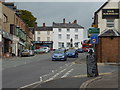
The lifestyle in DE56 1AJ is shaped by its proximity to retail and transport hubs. Nearby shops include Farmfoods Alfreton, Tesco Alfreton, and Lidl Alfreton, providing essential grocery and household services within easy reach. The presence of multiple railway stations adds convenience, allowing residents to access urban centres or rural areas quickly. While the data does not mention parks or leisure facilities, the absence of environmental constraints like AONB or protected woodlands suggests the area prioritises residential and commercial use over natural spaces. The combination of retail options and rail links creates a functional daily life, though those seeking extensive green spaces may need to travel further.
Amenities
Schools
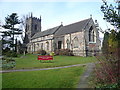
DE56 1AJ is served by a range of primary schools, including Croft Infant School and Copthorne Community Infant School, both of which have Ofsted ratings of ‘good’. Christ The King Catholic Primary and Christ the King Catholic Voluntary Academy also cater to local children, with the latter being an academy with a ‘good’ rating. For those requiring specialist education, Alfreton Park Community Special School provides support for students with specific needs. The mix of state and faith-based schools offers families choice, though the absence of secondary schools in the immediate area may require commuting. The presence of multiple primary options suggests a focus on early education, but parents should investigate secondary school options further afield.
| Rank | School | Type | Entry gender | Ages |
|---|
Explore more schools in this area
Go to Schools tabDemographics
The community in DE56 1AJ is predominantly composed of adults aged 30–64, with a median age of 47. This suggests a mature population, likely with long-term ties to the area. Home ownership rates are 48%, meaning nearly half of residents live in their own homes, while the remaining 52% are likely to be renters. The accommodation type is primarily houses, which is uncommon in high-density urban areas but aligns with the postcode’s compact, residential character. The predominant ethnic group is White, though the data does not provide further breakdowns of diversity. The absence of specific deprivation data means it is unclear how economic factors influence quality of life, but the high proportion of homeowners and stable age profile suggest a settled, low-turnover community.
Household Size
Accommodation Type
Tenure
Ethnic Group
Religion
Household Composition
Age
Household Deprivation
NS-SEC
Explore more demographic insights in this area
Go to Demographics tabPlanning
Planning Constraints
- Flood RiskPremium
- Ramsar Wetland SitesPremium
- Area of Outstanding Natural BeautyPremium
- Protected Nature ReservePremium
- Protected WoodlandPremium