Area Overview for DE56 0TA
Photos of DE56 0TA

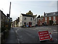

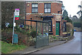
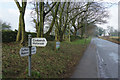


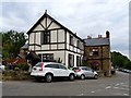
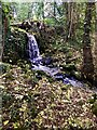
54 photos from this area
Area Information
Key information about the DE56 0TA including its size, population, and administrative classification.
- Area Type
- Postcode
- Area Size
- 3.6 hectares
- Population
- 1466
- Population Density
- 416 people/km²
House Prices in DE56 0TA
43
Properties
£207,856
Average Sold Price
£55,000
Lowest Price
£480,000
Highest Price
Showing 43 properties
| Address | Type | Beds | Baths | Last Sale Price | Last Sale Date | |
|---|---|---|---|---|---|---|
| Orchard House, Town Street, Holbrook, Belper, DE56 0TA | house | 4 | 1 | £480,000 | Sep 2024 | |
| Holly Cottage, 17 Town Street, Holbrook, Belper, DE56 0TA | Terraced | 3 | 1 | £195,000 | Jul 2024 | |
| 31 Town Street, Holbrook, Belper, DE56 0TA | house | 2 | 1 | £280,000 | Jul 2023 | |
| 45A Town Street, Holbrook, Belper, DE56 0TA | Detached | 3 | 2 | £410,000 | Aug 2019 | |
| 29A Town Street, Holbrook, Belper, DE56 0TA | Cottage | 2 | 1 | £252,000 | Apr 2019 | |
| 21 Town Street, Holbrook, Belper, DE56 0TA | Cottage | 2 | 1 | £284,000 | Jul 2018 | |
| 47 Town Street, Holbrook, Belper, DE56 0TA | Detached | 4 | - | £460,000 | Jun 2016 | |
| Keepers Cottage, 20A Town Street, Holbrook, Belper, DE56 0TA | Cottage | 2 | 1 | £124,995 | Feb 2016 | |
| 15 Town Street, Holbrook, Belper, DE56 0TA | Terraced | 3 | - | £190,000 | Jul 2014 | |
| 20 Town Street, Holbrook, Belper, DE56 0TA | house | - | - | £241,500 | Sep 2013 |
Page 1 of 5
Energy Efficiency in DE56 0TA
Amenities
Schools
| Rank | School | Type | Entry gender | Ages |
|---|
Explore more schools in this area
Go to Schools tabDemographics
Household Size
Two person
most common
Accommodation Type
Houses
most common
Tenure
82
majority
Ethnic Group
White
most common
Religion
N/A
most common
Household Composition
N/A
most common
Age
47
median
Adults (30-64 years)
most common
Household Deprivation
N/A
with no deprivation
NS-SEC
43
in Lower managerial occupations
Explore more demographic insights in this area
Go to Demographics tabPlanning
Planning Constraints
- Flood RiskPremium
- Ramsar Wetland SitesPremium
- Area of Outstanding Natural BeautyPremium
- Protected Nature ReservePremium
- Protected WoodlandPremium