Area Overview for DE56 0RD
Photos of DE56 0RD
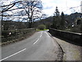
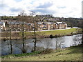
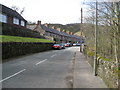
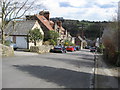


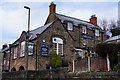
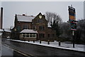
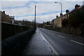
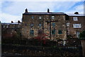
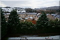

98 photos from this area
Area Information
Key information about the DE56 0RD including its size, population, and administrative classification.
- Area Type
- Postcode
- Area Size
- 5.2 hectares
- Population
- 1896
- Population Density
- 456 people/km²
House Prices in DE56 0RD
13
Properties
£382,556
Average Sold Price
£97,500
Lowest Price
£725,000
Highest Price
Showing 13 properties
| Address | Type | Beds | Baths | Last Sale Price | Last Sale Date | |
|---|---|---|---|---|---|---|
| The Fairway, Vicarage Road, Milford, Belper, DE56 0RD | Bungalow | 3 | 1 | £480,000 | Jun 2021 | |
| Rosemead House, Vicarage Road, Milford, Belper, DE56 0RD | house | 4 | 2 | £725,000 | Feb 2021 | |
| Innisfree, Vicarage Road, Milford, Belper, DE56 0RD | Detached | 3 | 1 | £327,450 | Jul 2015 | |
| Waverley, Vicarage Road, Milford, Belper, DE56 0RD | Detached | 3 | 2 | £358,000 | Nov 2014 | |
| Downwind, Vicarage Road, Milford, Belper, DE56 0RD | Detached | - | - | £275,000 | Oct 2008 | |
| The Seasons, Vicarage Road, Milford, Belper, DE56 0RD | Detached | - | - | £390,000 | Feb 2007 | |
| Pendle House, Vicarage Road, Milford, Belper, DE56 0RD | Detached | - | - | £407,500 | Mar 2006 | |
| Oberon, Vicarage Road, Milford, Belper, DE56 0RD | Detached | - | - | £97,500 | Aug 1997 | |
| Whindale, 1 Vicarage Road, Milford, Belper, DE56 0RD | Detached | 3 | - | - | - | |
| Ridgewood, Vicarage Road, Milford, Belper, DE56 0RD | Detached | - | - | - | - |
Page 1 of 2
Energy Efficiency in DE56 0RD
Amenities
Schools
| Rank | School | Type | Entry gender | Ages |
|---|
Explore more schools in this area
Go to Schools tabDemographics
Household Size
Two person
most common
Accommodation Type
Houses
most common
Tenure
81
majority
Ethnic Group
White
most common
Religion
N/A
most common
Household Composition
N/A
most common
Age
47
median
Adults (30-64 years)
most common
Household Deprivation
N/A
with no deprivation
NS-SEC
41
in Lower managerial occupations
Explore more demographic insights in this area
Go to Demographics tabPlanning
Planning Constraints
- Flood RiskPremium
- Ramsar Wetland SitesPremium
- Area of Outstanding Natural BeautyPremium
- Protected Nature ReservePremium
- Protected WoodlandPremium