Area Overview for DE56 0JH
Photos of DE56 0JH
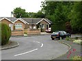
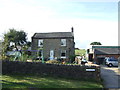
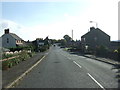
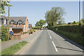
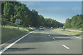
33 photos from this area
Area Information
Key information about the DE56 0JH including its size, population, and administrative classification.
- Area Type
- Postcode
- Area Size
- 5382 m²
- Population
- 1836
- Population Density
- 1839 people/km²
House Prices in DE56 0JH
16
Properties
£212,668
Average Sold Price
£77,950
Lowest Price
£295,000
Highest Price
Showing 16 properties
| Address | Type | Beds | Baths | Last Sale Price | Last Sale Date | |
|---|---|---|---|---|---|---|
| 16 Hillary Close, Belper, DE56 0JH | Detached | 3 | 2 | £295,000 | Feb 2025 | |
| 6 Hillary Close, Belper, DE56 0JH | house | - | - | £235,000 | Feb 2022 | |
| 20 Hillary Close, Belper, DE56 0JH | Detached | 4 | 3 | £285,000 | Jan 2022 | |
| 9 Hillary Close, Belper, DE56 0JH | house | - | - | £272,000 | Nov 2020 | |
| 10 Hillary Close, Belper, DE56 0JH | Detached | 3 | 1 | £218,000 | Jun 2019 | |
| 7 Hillary Close, Belper, DE56 0JH | Detached | 3 | 1 | £217,500 | Nov 2018 | |
| 8 Hillary Close, Belper, DE56 0JH | Detached | 3 | - | £199,950 | Jun 2017 | |
| 14 Hillary Close, Belper, DE56 0JH | Detached | 4 | 1 | £220,000 | Jan 2015 | |
| 12 Hillary Close, Belper, DE56 0JH | Detached | - | - | £162,000 | Dec 2004 | |
| 11 Hillary Close, Belper, DE56 0JH | Detached | 4 | 2 | £156,950 | Dec 2002 |
Page 1 of 2
Energy Efficiency in DE56 0JH
Amenities
Schools
| Rank | School | Type | Entry gender | Ages |
|---|
Explore more schools in this area
Go to Schools tabDemographics
Household Size
Family (3-5 people)
most common
Accommodation Type
Houses
most common
Tenure
83
majority
Ethnic Group
White
most common
Religion
N/A
most common
Household Composition
N/A
most common
Age
47
median
Adults (30-64 years)
most common
Household Deprivation
N/A
with no deprivation
NS-SEC
39
in Lower managerial occupations
Explore more demographic insights in this area
Go to Demographics tabPlanning
Planning Constraints
- Flood RiskPremium
- Ramsar Wetland SitesPremium
- Area of Outstanding Natural BeautyPremium
- Protected Nature ReservePremium
- Protected WoodlandPremium