Area Overview for DE56 0HT
Photos of DE56 0HT
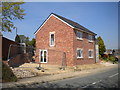
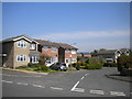
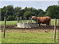
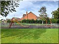
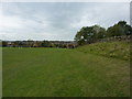
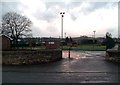
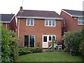
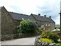
17 photos from this area
Area Information
Key information about the DE56 0HT including its size, population, and administrative classification.
- Area Type
- Postcode
- Area Size
- 4.3 hectares
- Population
- 1836
- Population Density
- 1839 people/km²
House Prices in DE56 0HT
54
Properties
£176,300
Average Sold Price
£36,750
Lowest Price
£480,000
Highest Price
Showing 54 properties
| Address | Type | Beds | Baths | Last Sale Price | Last Sale Date | |
|---|---|---|---|---|---|---|
| 59 Nailers Way, Belper, DE56 0HT | Detached | 4 | 2 | £480,000 | Jul 2025 | |
| 14 Nailers Way, Belper, DE56 0HT | Detached | 4 | 2 | £390,000 | Jun 2025 | |
| 18 Nailers Way, Belper, DE56 0HT | house | 3 | 2 | £310,000 | Mar 2025 | |
| 49 Nailers Way, Belper, DE56 0HT | Semi-detached | 2 | 1 | £179,500 | Mar 2025 | |
| 41 Nailers Way, Belper, DE56 0HT | Terraced | 1 | - | £125,000 | Sep 2024 | |
| 8 Nailers Way, Belper, DE56 0HT | Detached | 3 | 1 | £290,000 | Nov 2023 | |
| 32 Nailers Way, Belper, DE56 0HT | Semi-detached | 2 | 1 | £175,000 | Apr 2022 | |
| 15 Nailers Way, Belper, DE56 0HT | house | 3 | - | £257,000 | Sep 2021 | |
| 47 Nailers Way, Belper, DE56 0HT | Terraced | 3 | 1 | £155,000 | Nov 2019 | |
| 6A Nailers Way, Belper, DE56 0HT | Detached | 3 | 1 | £215,000 | Jun 2019 |
Page 1 of 6
Energy Efficiency in DE56 0HT
Amenities
Schools
| Rank | School | Type | Entry gender | Ages |
|---|
Explore more schools in this area
Go to Schools tabDemographics
Household Size
Family (3-5 people)
most common
Accommodation Type
Houses
most common
Tenure
83
majority
Ethnic Group
White
most common
Religion
N/A
most common
Household Composition
N/A
most common
Age
47
median
Adults (30-64 years)
most common
Household Deprivation
N/A
with no deprivation
NS-SEC
39
in Lower managerial occupations
Explore more demographic insights in this area
Go to Demographics tabPlanning
Planning Constraints
- Flood RiskPremium
- Ramsar Wetland SitesPremium
- Area of Outstanding Natural BeautyPremium
- Protected Nature ReservePremium
- Protected WoodlandPremium