Area Overview for DE56 0ER
Photos of DE56 0ER

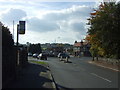

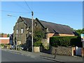
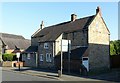
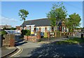

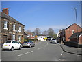
29 photos from this area
Area Information
Key information about the DE56 0ER including its size, population, and administrative classification.
- Area Type
- Postcode
- Area Size
- 2.0 hectares
- Population
- 1383
- Population Density
- 4896 people/km²
House Prices in DE56 0ER
47
Properties
£167,542
Average Sold Price
£28,000
Lowest Price
£400,000
Highest Price
Showing 47 properties
| Address | Type | Beds | Baths | Last Sale Price | Last Sale Date | |
|---|---|---|---|---|---|---|
| 16 Naseby Road, Openwoodgate, Belper, DE56 0ER | house | - | - | £220,000 | Jan 2023 | |
| 3 Naseby Road, Openwoodgate, Belper, DE56 0ER | Detached | 3 | 2 | £292,500 | Sep 2022 | |
| 30 Naseby Road, Openwoodgate, Belper, DE56 0ER | Detached | 4 | 1 | £275,000 | Dec 2021 | |
| 43 Naseby Road, Openwoodgate, Belper, DE56 0ER | Detached | 3 | - | £253,000 | Nov 2021 | |
| 6 Naseby Road, Openwoodgate, Belper, DE56 0ER | house | - | - | £230,000 | Jun 2021 | |
| 37 Naseby Road, Openwoodgate, Belper, DE56 0ER | Detached | 3 | 2 | £202,000 | Dec 2020 | |
| 8 Naseby Road, Openwoodgate, Belper, DE56 0ER | Detached | 3 | 2 | £220,000 | Jan 2020 | |
| 20 Naseby Road, Openwoodgate, Belper, DE56 0ER | Detached | 4 | 2 | £400,000 | Nov 2019 | |
| 27 Naseby Road, Openwoodgate, Belper, DE56 0ER | Detached | 4 | 2 | £241,000 | Dec 2017 | |
| 7 Naseby Road, Openwoodgate, Belper, DE56 0ER | Semi-detached | 2 | 1 | £126,000 | Sep 2017 |
Page 1 of 5
Energy Efficiency in DE56 0ER
Amenities
Schools
| Rank | School | Type | Entry gender | Ages |
|---|
Explore more schools in this area
Go to Schools tabDemographics
Household Size
Two person
most common
Accommodation Type
Houses
most common
Tenure
83
majority
Ethnic Group
White
most common
Religion
N/A
most common
Household Composition
N/A
most common
Age
47
median
Adults (30-64 years)
most common
Household Deprivation
N/A
with no deprivation
NS-SEC
38
in Lower managerial occupations
Explore more demographic insights in this area
Go to Demographics tabPlanning
Planning Constraints
- Flood RiskPremium
- Ramsar Wetland SitesPremium
- Area of Outstanding Natural BeautyPremium
- Protected Nature ReservePremium
- Protected WoodlandPremium