Area Overview for DE56 0DL
Photos of DE56 0DL
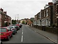
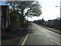
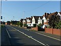
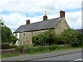
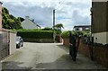
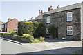
20 photos from this area
Area Information
Key information about the DE56 0DL including its size, population, and administrative classification.
- Area Type
- Postcode
- Area Size
- 1.0 hectares
- Population
- 1383
- Population Density
- 4896 people/km²
House Prices in DE56 0DL
20
Properties
£208,395
Average Sold Price
£62,250
Lowest Price
£375,100
Highest Price
Showing 20 properties
| Address | Type | Beds | Baths | Last Sale Price | Last Sale Date | |
|---|---|---|---|---|---|---|
| 1 Blackden Close, Belper, DE56 0DL | Bungalow | 3 | 1 | £295,000 | Mar 2025 | |
| 11A Blackden Close, Belper, DE56 0DL | Bungalow | 2 | 1 | £185,000 | Jul 2024 | |
| 19 Blackden Close, Belper, DE56 0DL | Bungalow | - | - | £224,000 | Jul 2023 | |
| 3 Blackden Close, Belper, DE56 0DL | Bungalow | 3 | - | £375,100 | Oct 2022 | |
| 5 Blackden Close, Belper, DE56 0DL | Bungalow | 3 | - | £245,000 | Jan 2019 | |
| 9 Blackden Close, Belper, DE56 0DL | Bungalow | 3 | 1 | £180,000 | Sep 2017 | |
| 17 Blackden Close, Belper, DE56 0DL | Bungalow | 2 | 1 | £150,000 | Dec 2016 | |
| 6 Blackden Close, Belper, DE56 0DL | house | - | - | £201,000 | Nov 2009 | |
| 8 Blackden Close, Belper, DE56 0DL | Detached | - | - | £249,995 | Jun 2007 | |
| 10 Blackden Close, Belper, DE56 0DL | Detached | - | - | £125,000 | May 2002 |
Page 1 of 2
Energy Efficiency in DE56 0DL
Amenities
Schools
| Rank | School | Type | Entry gender | Ages |
|---|
Explore more schools in this area
Go to Schools tabDemographics
Household Size
Two person
most common
Accommodation Type
Houses
most common
Tenure
83
majority
Ethnic Group
White
most common
Religion
N/A
most common
Household Composition
N/A
most common
Age
47
median
Adults (30-64 years)
most common
Household Deprivation
N/A
with no deprivation
NS-SEC
38
in Lower managerial occupations
Explore more demographic insights in this area
Go to Demographics tabPlanning
Planning Constraints
- Flood RiskPremium
- Ramsar Wetland SitesPremium
- Area of Outstanding Natural BeautyPremium
- Protected Nature ReservePremium
- Protected WoodlandPremium