Area Overview for DE55 7ZY
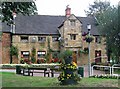
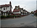
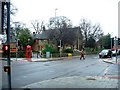
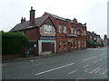
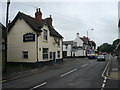
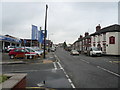
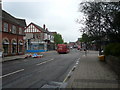
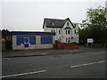
Photos of DE55 7ZY


Area Information
DE55 7ZY is a small, tightly knit residential postcode in England, home to 1,712 residents spread across a compact area with a population density of 860 people per square kilometre. This is a community defined by its proximity to local amenities and a mix of family-oriented living. The area’s character is shaped by its modest size, where daily life revolves around nearby shops, schools, and rail connections. With a median age of 47, the population skews toward adults aged 30–64, suggesting a stable, established demographic. While the area lacks the density of larger towns, its small footprint ensures a sense of familiarity among residents. The presence of multiple primary schools and retail outlets within walking distance makes it practical for families, while the nearby rail network offers access to broader regional opportunities. For those seeking a quiet, manageable community with essential services on hand, DE55 7ZY offers a straightforward, no-frills lifestyle.
- Area Type
- Postcode
- Area Size
- Not available
- Population
- 1712
- Population Density
- 860 people/km²
DE55 7ZY is primarily a residential area with a housing stock dominated by houses rather than flats or apartments. With a home ownership rate of 48%, the market reflects a mix of owner-occupied properties and rental units, suggesting a modest but active property scene. The small size of the postcode means the available housing stock is limited, likely concentrated around family homes suited to the area’s adult demographic. Buyers should expect a focus on single-family dwellings, with limited scope for high-density development. The proximity to rail stations and schools may make the area appealing to families seeking a balance between suburban living and accessibility. However, the small size of the postcode means competition for properties could be keen, particularly for homes in well-maintained condition.
House Prices in DE55 7ZY
No properties found in this postcode.
Energy Efficiency in DE55 7ZY
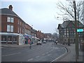
Daily life in DE55 7ZY is shaped by its proximity to essential amenities. Within practical reach are retail outlets such as Tesco Alfreton, Farmfoods Alfreton, and Lidl Alfreton, offering a range of shopping options for groceries and household needs. The area’s rail network, with stations at Alfreton, Ambergate, and Whatstandwell, provides access to broader regional services and employment opportunities. While the data does not mention parks or leisure facilities, the presence of multiple schools and shops suggests a focus on practicality over expansive recreational spaces. The small-scale nature of the area means amenities are concentrated, making them easy to access without long commutes. For residents valuing convenience and a straightforward lifestyle, DE55 7ZY’s amenities deliver a functional, community-oriented environment.
Amenities
Schools
Residents of DE55 7ZY have access to a range of primary and specialist schools. Croft Infant School and Copthorne Community Infant School both hold Ofsted ratings of ‘good’, offering reliable early education options. Christ The King Catholic Primary provides a faith-based alternative, while Alfreton Park Community Special School caters to students with specific needs. For secondary education, Christ the King Catholic Voluntary Academy, rated ‘good’ by Ofsted, serves the area. This mix of school types ensures families can choose between mainstream, faith-based, or specialist education. The presence of multiple primary schools within walking distance makes the area particularly suitable for parents prioritising convenience. However, the absence of secondary schools within the postcode means students may need to travel to nearby towns for higher education.
| Rank | School | Type | Entry gender | Ages |
|---|
Explore more schools in this area
Go to Schools tabDemographics
The population of DE55 7ZY is predominantly adults aged 30–64, with a median age of 47. This suggests a mature, settled community with a focus on family life and long-term residency. Home ownership rates stand at 48%, meaning nearly half of residents rent their homes, reflecting a balance between owner-occupied properties and rental housing. The area is characterised by houses rather than flats, indicating a traditional suburban or semi-rural layout. The predominant ethnic group is White, though no specific data on diversity or deprivation is provided. With a population density of 860 people per square kilometre, the area avoids the overcrowding of denser urban zones but still maintains a close-knit feel. For those prioritising stability and a slower pace of life, DE55 7ZY’s demographic profile aligns with a community that values continuity over rapid change.
Household Size
Accommodation Type
Tenure
Ethnic Group
Religion
Household Composition
Age
Household Deprivation
NS-SEC
Explore more demographic insights in this area
Go to Demographics tabPlanning
Planning Constraints
- Flood RiskPremium
- Ramsar Wetland SitesPremium
- Area of Outstanding Natural BeautyPremium
- Protected Nature ReservePremium
- Protected WoodlandPremium