Area Overview for DE55 7QA
Photos of DE55 7QA

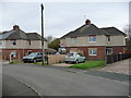
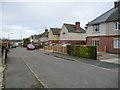
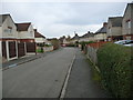
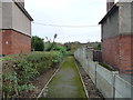
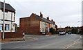
25 photos from this area
Area Information
Key information about the DE55 7QA including its size, population, and administrative classification.
- Area Type
- Postcode
- Area Size
- 9893 m²
- Population
- 1887
- Population Density
- 3342 people/km²
House Prices in DE55 7QA
25
Properties
£119,115
Average Sold Price
£35,000
Lowest Price
£180,050
Highest Price
Showing 25 properties
| Address | Type | Beds | Baths | Last Sale Price | Last Sale Date | |
|---|---|---|---|---|---|---|
| 30 Normanton Avenue, Alfreton, DE55 7QA | Terraced | 3 | 1 | £180,000 | Aug 2023 | |
| 18 Normanton Avenue, Alfreton, DE55 7QA | Semi-detached | 3 | 1 | £180,000 | Dec 2022 | |
| 9 Normanton Avenue, Alfreton, DE55 7QA | Terraced | 3 | 1 | £180,050 | Feb 2022 | |
| 3 Normanton Avenue, Alfreton, DE55 7QA | Terraced | 3 | 1 | £115,000 | Jan 2020 | |
| 12 Normanton Avenue, Alfreton, DE55 7QA | Semi-detached | 3 | 2 | £117,000 | Jan 2020 | |
| 6 Normanton Avenue, Alfreton, DE55 7QA | Semi-detached | 4 | - | £120,000 | Nov 2019 | |
| 19 Normanton Avenue, Alfreton, DE55 7QA | Terraced | 3 | 1 | £120,000 | Sep 2018 | |
| 7 Normanton Avenue, Alfreton, DE55 7QA | Terraced | 3 | 1 | £117,000 | Dec 2017 | |
| 24 Normanton Avenue, Alfreton, DE55 7QA | Terraced | 3 | - | £114,995 | Jun 2016 | |
| 11 Normanton Avenue, Alfreton, DE55 7QA | Semi-detached | 3 | - | £116,950 | Aug 2013 |
Page 1 of 3
Energy Efficiency in DE55 7QA
Amenities
Schools
| Rank | School | Type | Entry gender | Ages |
|---|
Explore more schools in this area
Go to Schools tabDemographics
Household Size
Two person
most common
Accommodation Type
Houses
most common
Tenure
76
majority
Ethnic Group
White
most common
Religion
N/A
most common
Household Composition
N/A
most common
Age
47
median
Adults (30-64 years)
most common
Household Deprivation
N/A
with no deprivation
NS-SEC
26
in Lower managerial occupations
Explore more demographic insights in this area
Go to Demographics tabPlanning
Planning Constraints
- Flood RiskPremium
- Ramsar Wetland SitesPremium
- Area of Outstanding Natural BeautyPremium
- Protected Nature ReservePremium
- Protected WoodlandPremium